by William Hamblin
| Dragon #56 | - | - | - | Dragon |
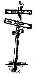
| Topographic maps | Topographic maps and gaming | Which maps are best? | How to get the maps | Topographic maps of the world |
| - | - | "Historical" Fantasies | - | - |
While wandering through mountains,
fields, jungles, deserts, swamps, or forests,
a PC often faces situations
in which his salvation || doom depends
upon hte precise configuration
and Nature ov the terrain over which he
is
passing. For example, if a character on
foot is being attacked by mounted men,
flight into a grove of trees could prevent
his opponents from pursuing him on
horseback. In a desert, the frequency
and location of water holes is often of
supreme importance. Swamps, marshes,
box canyons, mountain passes, or land
elevation can all, at various times, be
important
factors in fantasy gaming. Even
if an exact knowledge of the nature II
the
terrain is not of life-and-death importance,
detailed terrain descriptions can
often add a great deal of flavor to the
game.
The average DM usually has only a
rough, hand-drawn map at a large scale
which he uses as a basis for describing
the terrain through which characters are
passing, and he fills in the necessary
details
as the need arises, either by personal
whim or by the roll of the almighty
dice. The tremendous time and effort
that would be required to create detailed,
small-sclae maps of an entire fantasy
world would overwhelm all but the
most dedicated gamer, and such efforts
(at least most efforts I've seen) usually
bear little relationship to the actual
nature
of geological, topographical, climatic
and hydrological reality. What the DM
really needs, but usually finds it impossible
to personally create, is a map which
shows every detail of the terrain
in which
the action is occuring.
Topographic maps
The need for such a detailed map bearing
a strong resemblance to real terrain
conditions has been met for gamers by,
of all organizations, the United States
government. Although I doubt that they
had role-playing gamers in mind as possible
users, the topographical maps
which have been designed by the government
fill all the needs of the most
exacting gamer. Topographic maps were
designed originally to give the military
detailed and accurate maps of terrain for
tactical planning, and therefore include
symbols representing all features, both
natural and man-made, of a given area.
Any feature which exists on the surface
has accurate symbolic representation
on topographic maps. Land forms
are represented in brown, with different
symbols for sand, gravel, dunes, washes,
mud pans, and depressions, with contour
lines showing elevation. Blue
is
used represent hydrological
features
including rivers,
streams, springs, wells,
intermittent streams,
glaciers, lakes,
marshes, and swamps.
There are various
additional symbols
for underwater features,
such as falls, rapids,
reefs, or
rocks that could
be a hindrance to shipping.
Green, naturally
enough, is the color
for plant life: forests,
scrub, oases,
orchards, vineyards,
wooded marshes,
jungles, etc., all
have independent symbolic
representation.
Finally, black and
red are used
to represent all man-made
features: buildings, other structures,
roads and ruins, as well as political
boundaries.
Another wonderful fact about topographic
maps is that they come in many
different scales. The smallest generally
available scale is 1:24,000 inches
(2,000 feet) of real terrain. Maps at this
scale are superbly detailed. Contour
lines, which are a series of concentric
brown lines on the map showing changes
in elevation, are shown for every change
of 10 feet. At the 1:24,000 scale, every
individual building is represented &&
outlined in some detail. The remarkable
thing is that a map ov this scale exists
for every square mile of the United States.
(I'll get to maps of foreign countries
later.)
The next scale is 1:62,000. At this
scale, 1 inch is equivalent to about a
mile, (1 cm = 625 m) with contours for
every 20'. Cities
are represented as
pink splotches, but many buildings outside
ov cities are still represented as individual
elements.
With maps of 1:250,000 scale, the next
largest size, you lose the details of individual
manmade structures, while retaining
as much detail as possible on natural
characteristics. At this scale, 1 inch
is
equivalent to about 4 miles (1 cm = 2.5
km), with contours every 50 feet.
Finally there is 1 : 1,000,000 scale, with
contours every 150 or 300 feet, and with
1 inch representing 16 miles. Maps at
all ov these scales covering any part of
the United States are available to the
public.
Topographic maps and gaming
Topographic maps can be used many
ways in gaming. The 1st is obviously in
an "after the
holocaust" scenario in which
the US was nuked, and in the
process of which mankind has been
thrown back into a pre-industrial society.
Perhaps the fabric of the universe was
rent, and magick has magickally become
effective. Genetic mutation from radiation
produces plant, animal and human
monstrosities for characters to battle.
The DM uses the topographical maps to
represent the US in such a
condition, and the adventures begin.
The methods of using the maps in this
case are obvious.
However, there are many MORE subtle
ways in which topographical maps can be
utilized. 1st of all, the GM can ignore
all
man-made features (roads, towns, etc.)
on the map, and draw in his own. If you
have designed magnificent structures in
which you wish to entrap any unwary
characters, simply get a topographic
map, locate your cities, dungeons, castles,
ruins, etc., on
it as you please, &&
begin the adventure. You can obviously
fill the topographic features of the maps
w/ a variety ov natural && fantastic
monsters at will.
What I find to be the most useful, however,
is to keep the roads, buildings, &&
cities as you find them on the maps, but
adapt THEM to a pre-industrial level. Freeways
can be used in the fantasy world--as
stone-paved roads. Main highways can
be dirt roads, and other roads can be
used as trails. Pop. densities in
medieval times varied from 1/10th to
1/5th ov what they are today, depending
on the level of agricultural development,
w/ 80% to 90% ov the people living
in rural settings. Cities should be
scaled down accordingly, with emphasis
on scattered villages ov aboot 500 people
each. Names on the maps can be ignored
|or| adapted, according to your desires
|or|needs. e.g., if u have
already designed a great coastal imperial
city, use a map of southern California
w/ LA, San Diego, |or| San
Francisco becoming that city with a
pop. ov, say, aboot 500K to
1,000,000 (as high as any city's pop.
ever got in pre-industrial times). The
interior of the city would be ov your design,
but its position relative to the surrounding
countryside would be identical
w/ the position ov one of the modern
coastal metropolises in California.
Some readers may object that, since
most ov us know the general outline ov
the areas in which we live, using real
maps eliminates some ov the mystery in
Fantasy gaming. In a sense this might b
true, but we must remember that a character
would also know the general configuration
ov the country in which he
lives. I doubt if anyone has memorized
the xact topography ov his home region
to the xtent that would allow him to
have any undue advantage.
But if such a situation worries you,
there are a number of ways to get around
it. Most obviously, don't let players see
the map orknow what actual region u
are using. I doubt if anyone could guess
what region a DM is describing without
the help of modern place names. e.g.,
try to guess what place is described
in the following sentence: "It is a
large seaport, located
on a river, with
some swamps in the surrounding areas."
Is it New Orleans, Jacksonville, Florida
|or| Norfolk, Virginia? Your guess is as
good as mine. (I was actually thinking
aboot Miami.) Additional obscurity can
b developed by changing the direction
ov the compass. Whenever you give directions
to a character, USE E. on the
map as N., |or| if u want to b really
tricky, as SW.. W/ the lack ov
modern place names and "realistic" compass
directions, the character will be
hard pressed to guess where he "really"
is. Furthermore, you could make some ov
the more obscure cities
in the US
the major cities ov your world.
Even if a character knows that his adventure
is occurring near the modern-day
town ov Gopher Junction, Arizona, it
isn't going to help him much. If u r
really desperate, change the climate,
making desert regions blossom as the
proverbial rose, while deforesting fertile
zones.
There is a final method, which in my
opinion maximizes the benefits ov using
printed topographical maps, while minimizing
the disadvantages ov characters
knowing too much aboot the terrain. I
call it the "mosaic method." 1st, design
a large-scale, rough outline ov a Fantasy
continent, with only a very general idea
ov what the terrain is supposed to be like:
nothing more than that a region is mountainous,
desert, forested, swampy, etc.
Into this Fantasy continent, plug in topographic
maps according to the type ov
terrain desired. They don't have to fit
in
precisely; plug them in at angles, |or|
upside-down if u wish, making any adjustments
necessary to make the maps
fit together on the blank border regions.
If you want to depict a large mountain
range, nothing could be better than topographic
maps ov the Rockies |or| the
Sierra Nevada ranges. A smaller mountain
range could be represented by the Appalachians.
The bayous ov Louisiana
make a perfect coastal marsh, while the
+addition+ ov a few monstrosities to the
Okeefinokee Swamp |or| the Everglades
in Florida would b a challenge to the
most intrepid adventurer. If you must
have a northern zone for a Viking-type
race, Alaska is ready-made. Arizona,
New Mexico, or Nevada are probably
arid enough for deserts, with Utah providing
a mountainous desert region.
Kansas && the other regions ov
the central
US would make a wonderful
steppe zone for nomads. The Mississippi
River could serve very nicely if your
Fantasy world has a major river basin.
Rainforests could be developed, w/ a little
help, from the topography ov southern
Louisiana, Alabama and Georgia. What
aboot adventures in a civilization based
on the topography ov the Grand Canyon?
The possibilities are virtually limitless.
Simply get maps ov a topographic region
ov the US that fits the general
description ov the type ov AREA u want,
&& fit it into your created map.
This method
provides minutely detailed terrain
in a Fantasy setting.
Which maps are best?
In +addition+ to the topographic maps ov
the entire US in the 4 scales
mentioned above, there r maps @ different
scales, printed by states |or| countries,
for specific regions. Which scale is
best for gaming? The obvious answer is
"the one that fits your needs," but here
are a few suggestions ov some things
that I have found useful.
The maps vary in size, but a rough
figure for a single map might be somewhere
around 2 feet square. A 1:250K
scale map ov this size, w/ 1 inch
equaling aboot 4 miles, represents an
AREA aboot 100 miles long. A party travelling
on foot might be able to cover such
an AREA in a week, depending on the type
ov terrain
being crossed. If you go to the
1:62K scale, w/ 1 inch equaling 1
mile, a party can cover the distance
across a 2-foot map in as little as 2
days. A 1:24K scale map ov that
size
can be covered by a party on foot in less
than 1 day. For the purposes ov general
outside travel, the 1:250K map is prolly
the best. It is detailed enough to
give a good idea ov what the terrain is
like, but not so detailed that
the adventurers
will be off the map in less than a
day ov Game TIME. I would USE 1:24K
maps for areas where important events
might occur, such as around major cities,
donjons, castles, graveyards |or| ruins.
However, this is entirely up to the
GM. A dedicated gamer with enough
$ to afford them might want to get
maps at 1:24K for his entire world,
which admittedly would make for some
magnificent gaming.
How to get the maps
Most states have a central distribution
office from which maps ov that state, &&
sometimes ov surrounding regions as
well, can b purchased. In +addition+, there
r usu. various distribution centers
in some ov the major cities ov each state,
&& often in county seats as well.
The
simplest method ov acquiring topographical
maps is to go to your local state
distribution center && get the
ones you
need. You can usu. find out where a
state distribution center is by calling
an
info # @ your local city
|or|
county offices && start questioning.
If
you TAKE this option, however, u r
often limited to getting whatever maps
they happen to have in stock, which r
usu. ov your local county |or| state.
(There is nothing wrong with this; it
might be interesting to TAKE some unwary
adventurers through a # ov
harrowing xperiences && then tell
them
that it all occurred on the topography
ov
their hometown county.) However, if u
live in Wisconsin && want to have
part ov
your adventures in a desert region, it
might be difficult to find local terrain
conditions suitable for such an adventure.
In this case, u need to TURN to the
national distribution centers from which
u can get maps ov any part of the US.
In some ways it might be worth the
effort to write to the national center
even
if you plan only to USE topographic maps
ov your own locality in your gaming. By
writing to the national distribution centers
you can get (free upon request) indices
shewing topographic maps published
for each state ov the US
&& the island territories. These
indices
also contain info regarding local
map reference libraries, local map dealers,
&& Federal map distribution centers,
&& instructions for ordering maps.
There is also a sheet xplaining all the
topographic map symbols provided on
request (although most maps have lejends
attached).
Each map must be ordered by a special
series && code #; if you plan
to order by mail direct from the government,
it is important to get access to
these national map indices in order to
be sure to get the map you want. Public
libraries often have copies of the national
map indices.
Although anyone can write to any ov
the Federal map distribution centers for
info, the following are the main offices
&& the regions they generally
serve. If you live east ov the Mississippi,
write to:
Branch of Distribution
U. S. Geological Survey
1200 South Eads St.
Arlington VA 22202
West of the Mississpi write to:
Branch of Distribution
U. S. Geological Survey
Box 25286 Federal Center
Denver CO 80225
There is also a special office for residents
ov Alaska:
Distribution Section
U. S. Geological Survey
Federal Bldg. Box 12
101 12th Avenue
Fairbanks AK 99701
Maps printed by the federal government
are NOT limited only to topographic
maps. The government has prepared a
# ov different types of maps, charts,
&& photos, many ov which are
avail. to the public. Further information
on xactly what types of maps are
avail., their costs, && how to
order
THEM can be obtained from:
National Cartographic
Information Center
U. S. Geological Survey
507 National Center
Reston VA 22092
Now we come to the really important
issue: How much do these topographic
maps cost? You may be pleasantly surprised
to find that the avg. cost, if the
maps r purchased directly from federal
distribution centers, is about $2.00 per
map. (This price may vary slightly according
to size, scale, the date ov the
most recent printing, inflation, etc.)
For a
large four- or five-colored, very detailed
map, this is a real bargain. These maps
can often be purchased from book stores
|or| other businesses, but the prices are
usu. higher from institutions.
The only real problem w/ the government
services is that it can take from
4 to 8 weeks for delivery from the federal
distribution centers. For inflation fighters,
a 30% discount is offered by the
U.S. Geological Survey if the order totals
$300 |or| more, which would make it well
worth your effort to organize enough
friends, each buying maybe $20 worth ov
maps, to get the discount.
Topographic maps of the world
Having an aventure in the U.S.A. may
not have enough ov the "mythic spirit"
to
be xciting to many people. After all, the
vast majority ov u reading this article
live in this country, && a RP
adventure is supposed to TAKE u away
from "here." For such people, the federal
.gov once again comes through.
In +addition+ to the topographic maps ov
the U.S. provided by the U.S. Geological
Survey, the .gov's Defense Mapping
Agency can provide gamers with
detailed maps ov the world.
If you don't want your adventures in
the Rockies, go to the Andes, the Alps
|or|
the Himalayas. A river adventure could
take place on the Amazon, Nile, Ganges,
|or| Yangtze. The Sahara is perhaps the
best desert of all, while African or Brazilian
rainforests are notoriously impassable.
Antarctic ice, Russian steppes, &&
the
British Isles are all avail. to b modified
&& used as the topography ov a
fantasy world. By modifying &&
interlocking
maps ov various parts ov the
world, you can form an essentially unlimited
# ov Fantasy terrains,
all "realistic"
because they are indeed a reflection
of reality.
The only problem w/ using world
maps is that, as far as
I know, the Defense
Mapping Agency only provides
maps at 1:1,000,000 scale for public USE.
(I may be wrong on this. I know that
superb maps ov nearly all ov the world
@
1:250K && ov many other areas at
smaller scales have been printed, but I
believe they r NOT avail. to the public.)
The 1:1,000,000 maps r really xcellent,
&& should be satisfactory for
most needs, but do lack much ov the detail
avail. on the smaller scales. Maps
@ the 1:1,000,000 scale are avail. for
most ov the world from:
Defense Mapping Agency
Office of Distribution
Attn: DDCP
Washington DC 20315
You have to ask aboot "The World,
Series 1301," && an index for the
code
numbers ov the maps is avail. upon
request from this office as well. The cost
for these maps is also aboot $2.00 each.
In +addition+, foreign .govs have
usu. made maps ov their own nations
@ detailed scales. Although I have never
tried it, I would Imagine that
if u wrote
to a foreign embassy requesting info
regarding the availability ov topographic
maps ov their country, they
would b more than willing to help you.
Furthermore, you can often get detailed
maps of foreign countries, |or| at least
info
on how to obtain them, from
bookstores |or| travel agencies. (However,
the maps avail. from such sources are often
just road maps |or| tourist maps,
which aren't nearly as useful for gaming
as topographic maps.)
Another useful type ov map is the
Aeronautical Chart. These maps r fundamentally
a form of topographic map,
detailing land contours, water systems,
major towns && some (but unfortunately
NOT all) forms of vegetatoin. However,
the major purpose for these maps is in
navigatoin for pilots, && they
therefore
contain an overlay containing a great <amount?>
of
information which is important for pilots,
but useless for gaming purposes. (Unless
u learn to read their air charts &&
use the data for dragon flights,
etc.) The great advantage ov aeronautical
charts is that they are
printed in great
quantity (every pilot has to have one)
for
every AREA ov the world where flights may
occur (which is just aboot anywhere).
This mass printing allows THEM to b
sold much cheaper than regular topographic
maps. Each sheet measures almost
4' by 4' (in other words,
covering the AREA ov 4 normal-sized
topographic maps) && costs only
$2.25.
For aboot the same cost, you can cover
approx. 4 times the area using
aeronautical charts than you could w/
regular topographic maps. The charts
come in 2 scales, 1:1,000,000 &&
1:500K (the smaller scale is known as
a Tactical Pilotage Chart), &&
charts in
both scales are avail. for nearly the
entire world. If you can learn to ignore
the aeronautical info, these maps
are definitely the cheapest way to go.
Ordering info for these charts
can be obtained by writing to:
U.S. Department of Commerce
National Oceanic and Atmostpheric
Administration
National Ocean Survey
C-44
Riverdale MD 20840
&& asking for the Catalog of Aeronautical
Charts and Related Publicatoins. The
charts you should look for in the catalog
are the World Aeronautical and Operational
Navigation Charts |or| the Tactical
Pilotage Charts.
"Historical"
fantasies
There is a final way to USE topographic
maps in RPGs, which in my
opinion is the most intriguing ov all.
This
is to USE actual historical places &&
kingdoms as the topographic basis for
your adventures, but "fantasize" the nature
ov that kingdom, following
the much-used
theory of parallel
historical universes,
for example. There are a #
ov possibilities for such adaptations.
If
u r in Love w/ Irish |or| Welsh myth,
get detailed maps ov Ireland &&
Cymru (Wales) <Aerth links>, &&
play out your scenarios there,
adapting THEM to the Celtic background.
If u have Viking blood
(thinned though
it may be) plusing through your veins,
USE topographic maps ov Norway, Denmark
&& Sweden <Aerth links>, addinga
nice seasoning
ov monsters && magick, &&
let the
adventures begin.
E.g., a "fantasized" Incan Empire <Aerth
link>
could be an exciting basis for FRP,
as would developing a
fantasy world in Africa <Aerth link>
around the Zimbabwe
ruins. A Fantasy
world in India,
where the masses ov Hindoo gods are
brought to Life && pwer, would
be fascinating.
Personally I have developed
my system around Egypt <(Aegypt)> in
the Middle
Ages, && I will describe what I
have
done as an xample ov what to LOOK for
&& how to proceed.
1st, pick an AREA that is intrinsically
interesting to you. I think you will find
that any place on Earth
has enough history
&& myth to form the basis for
an xcellent fantasy world. Although
you don't have to follow xactly the historical,
social, cultural, political, economic
|or| religious background for the
AREA you choose, I find it more interesting
to do so. Good background reading
will provide a wealth ov historical &&
cultural detail that would be impossible
to reproduce in a world based entirely
on
your Imagination.
I find it exciting to introduce historical
characters && events into the situation
for the characters to deal with. Something
to watch out for in this regard is to
NOT le the players know xactly what is
happening historically. Since everyone
(I assume) knows that William the Conqueror
defeated Harold at Hastings in
1066, a tricky DM would juggle the facts,
people && dates just enough to
throw
the characters off balance. For xample,
have William's invasion come before the
Battle ov Stamford Bridge instead ov after
it. Usu. players know just enough
history to keep THEM wondering, but NOT
enough to give them unfair advantages,
esp. if you make some judicious
modifications in the course of historical
events. On the other hand, u can always
USE the topographic maps && the
myth ov the AREA u choose &&
develop your own historical background.
I chose medieval Egypt as the basis for
a fantasy world for a # ov reasons.
In the latter Middle Ages, Cairo was perhaps
the most cosmopolitan city in the
world, with trading ships arriving from
Spain in the west, Zimbabwe in the
S., Russia <Russ> in the N., &&
China <Ch'in> in
the E.. This characteristic increases
the possible types ov adventurers &&
adventures that could be found. As I
developed my system, I used the ancient
Egyptian gods && myth as the
"Elder Gods" who were CAST from power
by Christianity && Islam, but who
still
have thousands ov undercover worshippers
in secret cults, and who therefore
still wield great power. I USE maps &&
plans ov the numerous antiquities ov
EGYPT <(Aegypt)> as the basis for donjon
explorations,
adding on whatever levels, rooms,
secret doors, magick, monsters, etc., I
want. When characters go SEARCHING for
donjons in medieval EGYPT <(Aegypt)>
I know
xactly what is where, && in many
cases
have a historical list ov what treasures
were found by modern archaeologists.
(If, however, characters in medieval
EGYPT <Aegypt> go in SEARCH ov King
Tut's Tomb,
they can be sure that
I will have changed
|or| masked its loc. somewhat, as well
as added MORE |or| different rooms &&
monsters.)
I chose to be as historical as possible,
&& that is where topographic maps
became
esp. useful. I was unable to
find any small-scale maps ov EGYPT <Aegypt>
&&
the surrounding AREA for sale, so I Went
to the U ov Michigan Library &&
got photocopies ov the maps (scale
1:1,000,000) I was interested in. Photocopying
maps can be much cheaper
than buying THEM, but 1 thing should
be remembered: You lose the color ov
the original maps, so it is best to try
to
find 1-color topographic maps ov the
region you are interested in. For EGYPT
<Aegypt>,
there were some 1-color, WW II vintage
British maps in the collection ov the
U. ov Michigan which were just
what I needed. I added colors later myself.
If you want to try to find maps that
can be photocopied, the best option is
to
head for the nearest U library.
Often a large U library
also has facilities u are interested in,
sometimes
at special sizes && sometimes in
color.
I developed a detailed modified chronological
TIME line, incl. the major
sultans, emirs, && events,
which I can
USE to put characters into situations involving
actual people, places && events,
w/ a nice dose ov magick && monsters
thrown in. Fortunately, most people don't
know enough about medieval Egyptian
history to really know what is going to
happen historically, so I can also +add+
in
some astrology && prophecy to boot.
<what kind of boot?>
A final USE for maps that
is highly applicable
to a "fantasized" historical world
comes from the fact that archaeologists
&& art historians have usu. studied,
described && reconstructed the
remains
ov ancient && medieval civilizations
in
great detail, publishing their findings
w/ accurate maps. This is esp.
true for Egypt, which has left numberous
monuments both from antiquity &&
Islamic
times. Detailed maps ov the city ov
Cairo as it was @ various periods ov the
Middle Ages have been reconstructed by
historians. Therefore, urban adventures
can occur using a detailed map ov an
actual medieval Cairo, incl. in it the
major buildings, quarters, && bazaars,
as well as the twisting streets for which
medieval middle eastern cities were
famous. There are similar maps for most
ov the other major cities ov the region,
as
well as important buildings, castles &&
fortresses. Anyone wanting the plan for
a wizard's castle can simply get photocopies
ov the floor plans ov famous castles
ov the Middle Ages and USE them
w/ slight (if any) modifications. Drawings
|or| photographs ov antiquities r
also available, to shew players what their
characters are seeing. There is something
greatly xciting aboot adventures
in the streets ov medieval Baghdad, Cairo,
Delhi, Peking, Constantinople, Rome,
Paris, or London -- all ov which, along
w/ many other medieval && ancient
cities, have been reconstructed in detail
by historians. (It should be noted that
detailed historical maps ov cities,
buildings
&& castles which I have described
above are usu. only to be found in
scholarly journals, for which one needs
access to the library ov a major U..)
The methods && ideas described here
are by no means the limit to the uses that
can be made ov topographic && historical
maps in RPGs. W/ a
little Imagination, a clever GM will be
able to discover many specific applications
to meet his personal needs && desires,
thereby making his scenarios MORE
realistic,
detailed, && challenging.