APPENDIX:
THE WORLD OF WEATHER

<12.1 Initial
Weather Conditions>
ADQ: Why isn't there
any weather in
the AD&D game system?
My Druid
never uses the powerful
Call Lightning
unless the DM feels like
having a
storm!
ADA: My old friend
(and RPGA
Member) Dave Axler asked
the same
question, and did something
something about it.
Look
in Dragon #68.
(Polyhedron #12)
Intro
A system for determining the weather at
any time && place in
the campaign world is a necessary part
of a set of rules that defines
and describes that world. Yet weather,
by it's very nature, is
anything but systematic. Modern-day meteorologists,
armed with
all the equipment
&& knowledge that man has devised && accumulated,
still can't always predict with certainty
what the
weather will be from one day to the next
-- so how can a game designer
hope to accomplish what they cannot?
The resolution of this paradox lies in
the judicious USE of one of
the designer's most valuable tactics:
simplicity. The tables &&
text on these pages may not look simple
at first glance, but they
are simple indeed compared to what would
have been needed to
account for all the combinations of terrain,
climate, elevation, and
location that exist on Earth. The system
given here will enable a
DM to predetermine the important weather
conditions
that will prevail on any day (and for
days || weeks in advance,
if desired) at any loc. in the world.
The system has been constructed so that
parts of it, such as
the sections on wind chill
&& humidity, can be disregarded if the
DM prefers even more simplicity than the
designer built
in. The basic structure requires the DM
to consult only two
tables, and make a single dice roll, to
determine the temperature,
wind speed and direction, and precipitation
(if any) for any day
exc. one on which a special weather phenomenon
takes place.
Note that this system describes how to
determine weather conditions,
but does not explicitly describe the effects,
in game terms,
that the weather will have upon characters,
creatures, or
other elements present in the environment.
Information on the effects
of weather is presented in the first section
of this book, for
both players and DMs. The difference,
of course, is that the
DM will know exactly what the weather
conditions
are or will be, while PCs (and their players)
in most
cases only will be able to make general
inferences and observations
based on the info the DM imparts to them
-- and
they, unlike the DM, usu. will not know
what the weather has in
store for them during the hours and days
to come.

Basic
Assumptions
A day is about 24 hours in duration;
a year is 365 days in length, or thereabouts.
(Many <DMs> prefer to develop their
own calendars,
and a good number of those conveniently
divide the year into twelve identical months of 30 days each,
making each year 360 days long.)
Each year is divided into four
seasons, and each <4>
of the seasons is further divided into
three
months. <3>
The planet rotates in a counterclockwise
direction, as viewed
from a point above the north pole.
Temperatures are expressed in degrees
Farenheit, elevation in feet above sea
level, and
wind velocity in mph. Wind
direction is given as the
direction the wind is
coming from; a north wind blows
from N to S, not the
other way around.
The planet contains five climatic regions,
each described <5>
in detail below. The system considers
seven basic types of terrain, <7>
which are defined in the first part of
this book. Although these
terrain/climate designations do not directly
correspond with the
terrain && climate categories
given in the encounter tables in the
DMG and MM2,
translation is not
difficult.
If you use the DMG terrain categories,
consider scrub
and rough areas to be id. (for weather
determination) as
plain || forest, depending on which of
those latter areas the
terrain most closely resembles. Swamp
areas, whenever this
category is not specifically mentioned
(such as on the Temperature
Variation table), are considered as either
plain, forest, or seacoast,
depending on which of those three latter
types most obviously <3>
applies. A swamp devoid of vegetation
is a plain; a
swamp containing trees or other large
vegetation is a forest; and
a swamp adjacent to the ocean is seacoast.)
MM2
considers only three climatic categories:
cold, temperate, and <3>
tropical. To mesh that system with this
one, simply divide the sub-arctic
&& sub-tropical areas in half,
so that monsters encountered
in a cold climate will be found in the
arctic and in part of
the subarctic adjacent thereto. Those
encountered in a tropical
climate are found in the tropics and in
the adjacent half of the
subtropical AREA. And, monsters that occur
in a temperate climate
will be found in any AREA between the
two extremes, encompassing <2>
the temperate AREA (as described herein)
+ the adjacent
half of the sub-arctic and the adjacent
half of the sub-tropical AREA.
Climatic
Regions
Arctic
climate prevails in latitudes from 90º (the north || south pole)
to 66º (the approximate location of the Arctic Circle).
In this text, "arctic"
refers to the polar region in both the
northern &&
southern hemispheres (and id. gen. rule
applies to sub-arctic,
temperate, and sub-tropical regions, described
below). The arctic
is, in a word, c-c-cold. The temperature
sometimes rises
to tolerable levels in the height of summer, but
for most of the
year the arctic region is so frigid that it is essentially
uninhabitable, exc.
by characters who are outfitted for
survival in the
deep freese (and, of course, by creatures && monsters
that are adapted
to -- and might even thrive in -- this kind of
climate).
The winds in this
AREA gen. blow from east to west and seldom reach greater than moderate
velocity (15-20 mph) exc. during storms.
However, even a
light breeze can make a
drastic difference
in effective temperature when it is bitterly cold
to begin with; see
the section below on wind chill and its effects.
In every other climatic
AREA, the amount of precipitation a certain
locale receives
depends on the time of year, the type of terrain
in the locale, or
both. But in the arctic, time of year makes no
appreciable difference
and terrain distinctions are for the most
part irrelevant
since everything is covered with ice. (On the Temperature Variation table
below, the entries
are identical for arctic
hills &&
arctic mountains, and also for arctic desert && arctic
plains; temperatures
for an arctic forest AREA are not given, since
vegetation of the
normal sort cannot survive in this climate.) Precipitation in
the arctic is usu.
very light if it exists at all.
A
phenomenon unqiue to the arctic is the "midnight sun,"
which occurs during
spring && summer. Because the Earth rotates
around an axis that
is tilted with respect to The Sun, there is a
period of time each
year when the arctic region is in continual
daylight; at any
time during the planet's rotation, the arctic is
tilted toward The
Sun. The converse of this is the long arctic winter
night (the "noon
moon"?), when for an =equal= length of time in autumn &&
winter the region
is tilted away from The Sun and is in
constant twilight.
This difference in the amount of daylight each
day occurs at all
latitudes, of course (exc. right at the equator,
where day &&
night are of virtually identical length), but only in
the arctic are the
extremes of all-night days and all-day nights realized.
(See the Hours
of Daylight Table in the Optional Rules
section for more
info.)
Subarctic
climate is typical of areas from 65° latitude to 51°.
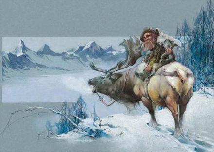
(In the northern
hemisphere, the southern boundary
of this AREA roughly
describes the border between the US
&& Canada.)
Winters are long
and cold,
but there is also
a season that can be legitimately called summer;
daytime temperatures
during the warm part of the year may reach or exceed 80°.
Winds are somewhat
more active here than in
the arctic. In the
winter, winds usu. blow from the arctic or on a
westerly angle from
the arctic (NW in the northern hemisphere,
SW in the southern
hemisphere), which in the summer
a prevailing westerly
or tropical W wind (SW in the
northern hemisphere,
NW in the southern hemisphere) is
more often the case.
Temperate climate
extends from 50° latitude to 31° (in the northern hemisphere, the
l. that roughly describes the border between the United States and
Mexico).
It is the Earth's AREA of climatic compromise,
and paradoxically also
the AREA where the greatest xtremes of
temperature are recorded.
As anyone who lives in the the American
Midwest can attest
to, a temperate winter can be a real bone-chiller
-- and on the
hottest days of a temperate summer, going
into a steam bath to
cool off can seem like a good  .
WInds can blow from the
N, S, or W, but almost never from the
E (exc.
along eastern seacoasts and in localized
areas, such as the
breeze that sometimes blows from Lake
Michigan across the
Wisconsin && Illinois shoreline;
see the discussion of Local Winds in
the Optional Rules section). Wind velocity
in the temperate
zone is as variable as the temperature.
Subtropical
climate predominates from 30 degrees latitude to 16 degrees (a l. running
along the southern edge of Mexico).
This AREA, like
the temperate zone, is one of climatic extremes,
but here they are
more closely related to terrain. The sub-tropical
AREA of Earth's
northern hemisphere includes the vast deserts of
Africa and Arabia,
where rain hardly ever falls, and also the forests &&
jungles of India
and SE Asia, where during the
summer it rains
almost constantly. The warm months can be very
warm -- as hot as
the tropics -- and in tthe cooler months, night-time
low temperatures
can actually be rather brisk. Winds in the
AREA are highly
variable in velocity, and they gen. blow from
the E or from the
E and toward the equator -- the "trade
winds" that explorers
from Europe took advantage of on their
journeys to the
New World.
Tropical
climate, in the area from 15 degrees latitude to 0 degrees (the equator)
is as consistently hot as the arctic is consistently cold.
The temperature
almost never drops below 70 degrees,
exc. during the
winter months at high elevation when
a "cold snap" of
65 || 60 degrees might occur. The summer is
blisteringly hot,
esp. in flat areas (desert && plains)at low
elevation, and even
being along the seacoast offers little relief.
Winds are gen. docile
(exc. during storms, of course), and
they most often
blow in id. direction as the sub-tropical
trade winds.
Table A1: TEMPERATURE
VARIATION
| - |
- |
Winter 12 |
1 |
2 |
Spring
3 |
4 |
5 |
Summer 6 |
7 |
8 |
Autumn
9 |
10 |
11 |
| Arctic |
D |
ABG |
ABH |
ACH |
AEH |
CGK |
FJL |
JKN |
JKM |
FHK |
DGJ |
ADH |
ABH |
| - |
F |
- |
- |
- |
- |
- |
- |
- |
- |
- |
- |
- |
- |
| - |
H |
ABE |
ABD |
ACF |
ADG |
BEI |
CFI |
DGL |
DGK |
CFJ |
CEH |
BEH |
ACE |
| - |
M |
ABE |
ABD |
ACF |
ADG |
BEI |
CFI |
DGL |
DGK |
CFJ |
CEH |
BEH |
ACE |
| - |
P |
ABG |
ABH |
ACH |
AEH |
CGK |
FJL |
JKN |
JKM |
FHK |
DGJ |
ADH |
ABH |
| - |
Se |
ACH |
ABH |
ACH |
AEJ |
CGK |
FJN |
JKP |
JKN |
EIL |
CGJ |
AEI |
ACI |
| - |
- |
Winter 12 |
1 |
2 |
Spring
3 |
4 |
5 |
Summer 6 |
7 |
8 |
Autumn
9 |
10 |
11 |
| Subarctic |
D |
ADI |
ADJ |
BEJ |
CGJ |
FKM |
JLN |
KMQ |
JMQ |
GKQ |
FHM |
CEL |
ACI |
| - |
F |
AEJ |
AEI |
BGK |
DJL |
HKN |
JLP |
KMR |
JMR |
IKP |
EJL |
BHK |
AFJ |
| - |
H |
ADI |
ADI |
BFJ |
CGJ |
FKN |
JLN |
JMP |
IMP |
GKM |
DJL |
BGK |
ADJ |
| - |
M |
ACI |
ADI |
AFJ |
BHL |
EJM |
IKM |
JLN |
IMO |
GKM |
DJL |
BFK |
ADJ |
| - |
P |
ADI |
ADJ |
BEJ |
CGJ |
FKM |
JLN |
KMQ |
JMQ |
GKQ |
FHM |
CEL |
ACI |
| - |
Se |
BFK |
BGK |
CHK |
DJM |
HKN |
JLR |
KMR |
KMR |
JLP |
EKM |
CHL |
AFK |
| - |
Sw |
|
|
|
|
|
|
|
|
|
|
|
|
| - |
- |
Winter 12 |
1 |
2 |
Spring
3 |
4 |
5 |
Summer 6 |
7 |
8 |
Autumn
9 |
10 |
11 |
| Temperate |
D |
KMS |
KMT |
LMT |
MNW |
MPX |
PPZ |
UYZ |
UYZ |
QWY |
NSX |
LRX |
KMR |
| - |
F |
CFL |
BFK |
EKP |
HLP |
KNU |
MPV |
MSX |
MSX |
LPV |
JNR |
FJL |
DJL |
| - |
H |
BIL |
CJM |
EKP |
ILR |
JOT |
JQX |
LTY |
LTY |
KQW |
JNT |
FKP |
CJM |
| - |
M |
AIL |
BIM |
CJN |
EKQ |
FLS |
KOV |
LQX |
KQW |
INU |
ELS |
CKR |
BJL |
| - |
P |
BHM |
CHN |
DKQ |
GLS |
KNU |
LPX |
MSY |
MSY |
KPW |
GLS |
EKQ |
CJM |
| - |
Se |
EJM |
FKN |
IKQ |
KLS |
KMT |
LOW |
MPX |
MPW |
LOW |
KLT |
GKP |
EKM |
| - |
Sw |
|
|
|
|
|
|
|
|
|
|
|
|
| - |
- |
Winter 12 |
1 |
2 |
Spring
3 |
4 |
5 |
Summer 6 |
7 |
8 |
Autumn
9 |
10 |
11 |
| Subtropical |
D |
LPT |
LPU |
MSW |
NTX |
OTX |
RVY |
TXZ |
TXZ |
RUY |
PUY |
NSX |
MPW |
| - |
F |
LTU |
LTV |
MTV |
NTW |
NTX |
PUX |
PUX |
PUX |
OUW |
NUW |
MSV |
LSV |
| - |
H |
KNQ |
KOR |
LQU |
MSV |
NTW |
OUX |
PUX |
PUY |
NSX |
MQV |
LPS |
KNR |
| - |
M |
KMP |
KMQ |
LPS |
LPT |
MQU |
NQU |
NPT |
NOR |
LOR |
LNQ |
LNQ |
KMP |
| - |
P |
LNR |
KOS |
MRU |
NSX |
RVX |
SWY |
TWZ |
TWZ |
SVY |
QVY |
MRU |
LPS |
| - |
Se |
LMU |
KMV |
KOW |
LPX |
MQX |
MSY |
NSY |
NSY |
MRX |
LQW |
KOU |
KMU |
| - |
Sw |
|
|
|
|
|
|
|
|
|
|
|
|
| - |
- |
Winter 12 |
1 |
2 |
Spring
3 |
4 |
5 |
Summer 6 |
7 |
8 |
Autumn
9 |
10 |
11 |
| Tropical |
D |
PRU |
PST |
PTW |
PUX |
QVY |
TWZ |
VYZ |
VYZ |
UXY |
UVX |
RUW |
QSV |
| - |
F |
MUW |
LUW |
MUW |
OUX |
OUX |
QUX |
QUX |
QUX |
QUX |
PUX |
OUW |
MUW |
| - |
H |
MPR |
NPT |
NRT |
PRU |
PTX |
QUY |
SWZ |
SWZ |
SVY |
QTW |
ORU |
NQT |
| - |
M |
MPR |
NPS |
NQT |
OQT |
OQU |
OQU |
NPT |
NPT |
NPT |
NPS |
MPS |
MPS |
| - |
P |
MPR |
NQT |
NRU |
PRU |
RWY |
TWY |
TWZ |
TWZ |
TWY |
RVY |
PSW |
NRU |
| - |
Se |
PSU |
PSV |
OTW |
QTX |
QTX |
RTY |
RTX |
RTX |
RTW |
QSV |
QSV |
PRV |
| - |
Sw |
|
|
|
|
|
|
|
|
|
|
|
|
The temperature figures for desert assume
an elevation of sea level; for plains && forest, 500 feet; for
hills, 2000 feet; and for mountains, 4000 feet.
If these terrain types exist at different
elevations than the ones given, subtract 3 degrees from the temperature
figures for every increase of 1000' (or
+add+ 3 degrees for
every decrease of 1000') if a more accurate
temperature
determination is desired.
Temperature Letter Codes
| Letter |
High |
Low |
Letter |
High |
Low |
Letter |
High |
Low |
Letter |
High |
Low |
| A |
-20 |
-40 |
H |
30 |
15 |
O |
70 |
55 |
U |
90 |
70 |
| B |
-15 |
-30 |
I |
35 |
15 |
P |
75 |
55 |
V |
90 |
75 |
| C |
-5 |
-20 |
J |
40 |
20 |
Q |
80 |
60 |
W |
95 |
75 |
| D |
0 |
-10 |
K |
50 |
30 |
R |
80 |
65 |
X |
100 |
80 |
| E |
10 |
0 |
L |
60 |
40 |
S |
85 |
65 |
Y |
105 |
80 |
| F |
18 |
10 |
M |
65 |
45 |
T |
85 |
70 |
Z |
115 |
85 |
| G |
25 |
10 |
N |
70 |
50 |
- |
- |
- |
- |
- |
- |
<finish colors?>
<note: from here on in, the alphanumerics
have been added into the sections>
A1: How to Use the Temperature Variation
Table
Each terrain/climate type is represented
by a set of twelve <12>
three-letter codes that describe the general
temperature conditions <3>
of that AREA during each month of the
year. The first letter <1st>
identifies the lowest temperatures that
will normally occur; the
third letter identifies the highest temperatures
that will normally
occur, and the second letter represents
the mean, or avg.,
high && low temperatures for that
AREA.
e.g., the code
for a sub-tropical
plains AREA in the seventh month of the year <7th>
(early summer) is T
W Z.
The T indicates that
the lowest temperature during that month will almost never be lower than
70;
the Z indicates that
the temperature can rise as high as 115 on the hottest days;
and the W indicates
that on most days,
the high temperature
will be 95 and the low temperature 75.
At the beginning of an adventure or an
episode (such as when
PCs find themselves abruptly transported
to a different
AREA), USE the second letter to ascertain
the current temperature
conditions. From this starting point,
the temperature will
MOVE up || down on a daily basis according
to the results of the
Day-to-Day Change Table (below).
As a general rule, the lowest temperature
of the day will occur
just bef. sunrise, and the  will gradually rise until the
high temperature for the day is reached
in early afternoon. After
possibly remaining at the high point for
a few hours (DM's discretion),
the  will decrease gradually through the evening
&& night until the next low point
is reached just bef. sunrise
on the following day. Of course, this
general rule should be modified
or disregarded in special weather conditions
or when the
DM judges that different times for high
&& low temperatures should prevail.
Table A2: DAY-TO-DAY
CHANGE
| Dice Roll |
Temp. Change |
Chance of
Precipitation |
Wind Conditions |
| 2 |
-3 steps |
yes |
Very strong ** |
| 3 |
-2 steps |
no |
From arctic, + 15 mph * |
| 4 |
-2 steps |
yes |
From arctic, + 10 mph * |
| 5 |
-1 step |
no |
Prevailing direction, + 15 mph * |
| 6 |
-1 step |
yes |
Prevailing direction, + 10 mph * |
| 7 |
no change |
same |
Same as previous day |
| 8 |
+1 step |
yes |
Prevailing direction, -10 mph |
| 9 |
+1 step |
no |
Prevailing direction, -15 mph |
| 10 |
+2 steps |
yes |
From tropics, -10 mph |
| 11 |
+2 steps |
no |
From tropics, -15 mph |
| 12 |
+3 steps |
yes |
Very slight ** |
* -- Wind velocity in arctic and tropical
climatic regions does not exceed 20 mph exc. in special conditions;
in subarctic climate,
25-30 mph is the normal maximum.
** -- Consult Table A4: Special
Weather <slight variance in transcription: this format is continued
throughout>
A2: How to Use the Day-to-Day Change
Table
Roll 2d6 for each day
beyond the present one,
either by day as needed or for a number
of days in succession as desired.
Use two dice that are different in color
or size,
so that they can be designated as "die
1" and "die 2."
This distinction is important
whenever there is a chance of precipitation,
as explained below.
Follow the instructions
below for how to interpret each category
on the Day-to-Day Change Table.
Temperature Change: MOVE up or down
the letter scale as required
to ascertain what the next day's high
&& low temperatures
will be be. If the present temperature
is within the allowable
range (as indicated by the first &&
third letters of the Temperature Code) <1st && 3rd>
but a MOVE dictated by this table would
take the result
beyond that range, then stop whent he
extreme result is reached.
Example: The current temperature in a subarctic
forest in the first month of winter is H, and the 2d6 roll yields a 12.
Instead of going up three steps (to K,
which is beyond the upper limit), increase <3>
the temperature to J for the following
day.
If the current temperature
is already at the upper limit,
treat any "plus" result as "no change"
and treat a roll of 7 id. as a roll of 6 --
that is,
the temperature drops by 1 step and precipitation
is possible.
If the temperature remains at the upper
limit for two consecutive days,
treat a roll of 7 or 8 as a roll of 6,
and continue this pattern until the streak
of hot weather ends.
(For a streak of cold weather, perform
id. process with the other
end of the table.)
Chance of Precipitation:
If the dice roll indicates a "yes" result
in this column,
note the numbers that came up on die 1
and die 2 and consult Table A3: Precipitation Variation.

Wind Conditions:
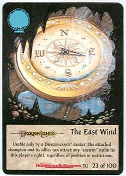 -
- 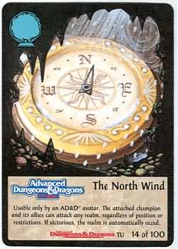 -
-  -
-
Atroa
(goddess of the east wind)
Sotillon
(goddess of the south wind)
Telchur
(god of the north wind)
Wenta
(goddess of the west wind)
On a dice roll of 3 through 11,
this column is used to determine the direction
and velocity of the wind.
Note that a wind from the arctic will
be a N wind in the northern hemisphere
and a S wind in the southern hemisphere;
the esrever
is true for a wind from the tropics. The
"prevailing direction" is as
described above in the .txt for the various
climatic regions.
The velocity increment (+ 15 mph, + 10
mph, etc.) is added to the wind velocity for the previous day.
Obviously,
wind velocity cannot fall below zero,
and exc. in special circumstances it will
not increase beyond 45 mph.
Exceptions to this rule for arctic, sub-tropical,
and sub-arctic
climates are noted beside the Day-to-Day
Change Table.
Wind velocity represents the highest SPEED
the wind will reach
on the day in  ,
during gusts that can last anywhere from
a few seconds to a few minutes. For the
REST of the day, the wind
SPEED will be no more than half of the
indicated max. velocity. <1/2>
For example,
the maximum wind velocity for the present
day has been determined as 15 mph.
A roll of 3 on Table A2: Day-to-Day
Change indicates that the maximum velocity for the following day will
be 30 mph.
This means that gusts up to 30 mph will
occur (at times determined by the DM),
but in general the wind speed on the following
day will average about 15 mph.
If precipitation occurs on a given day,
the max. wind
SPEED for that day will usu. occur immed.
bef. && during
the precipitation. The current wind SPEED
can serve as
an indicator of how long the precipitation
lasts: On a very windy day,
the precipitation will usu. occur over
a short duration; the
clouds containing the rain || snow will
be moving rapidly through
the upper atmosphere. On a relatively
calm day, the rain clouds
MOVE more slowly, and precipitation that
occurs in a certain loc.
will usu. be less intense and more prolonged.
If the dice roll on Table A2: Day-to-Day
Change is 2 or 12,
follow the normal procedure for determining
temperature change,
chance of precipitation,
and wind conditions,
and then refer to Table A4: Special
Weather <(page 112)> to see if some extraordinary weather occurs
on the day in question.
Table A3: PRECIPITATION
VARIATION
| - |
- |
Winter A |
B |
C |
Spring
A |
B |
C |
Summer A |
B |
C |
Autumn
A |
B |
C |
| Arctic |
D |
- |
T |
- |
- |
T |
- |
- |
T |
- |
- |
T |
- |
| - |
H |
- |
- |
T |
- |
- |
T |
- |
- |
T |
- |
- |
T |
| - |
M |
- |
- |
T |
- |
- |
T |
- |
- |
T |
- |
- |
T |
| - |
P |
- |
T |
T |
- |
L |
T |
- |
M |
L |
- |
T |
T |
| - |
Se |
- |
T |
- |
- |
L |
T |
- |
L |
T |
- |
L |
T |
| - |
- |
Winter A |
B |
C |
Spring
A |
B |
C |
Summer A |
B |
C |
Autumn
A |
B |
C |
| Subarctic |
D |
- |
T |
- |
- |
- |
T |
- |
- |
T |
- |
T |
- |
| - |
F |
- |
L |
T |
T |
M |
L |
T |
M |
L |
T |
L |
T |
| - |
H |
- |
T |
T |
- |
L |
T |
T |
L |
L |
- |
L |
T |
| - |
M |
- |
T |
T |
T |
M |
L |
T |
L |
T |
- |
L |
T |
| - |
P |
- |
L |
T |
T |
M |
L |
T |
M |
L |
T |
L |
T |
| - |
Se |
- |
T |
T |
- |
L |
T |
T |
M |
L |
- |
L |
T |
| - |
Sw |
- |
L |
T |
T |
M |
L |
T |
L |
L |
T |
L |
L |
| - |
- |
Winter A |
B |
C |
Spring
A |
B |
C |
Summer A |
B |
C |
Autumn
A |
B |
C |
| Temperate |
D |
- |
T |
- |
- |
T |
- |
- |
T |
- |
- |
- |
- |
| - |
F |
T |
M |
L |
L |
H |
M |
L |
M |
M |
L |
M |
M |
| - |
H |
T |
M |
L |
L |
H |
M |
L |
H |
M |
T |
M |
L |
| - |
M |
- |
M |
L |
- |
M |
L |
- |
L |
T |
- |
M |
L |
| - |
P |
- |
L |
T |
L |
H |
M |
L |
H |
M |
T |
M |
L |
| - |
Se |
L |
H |
M |
T |
M |
L |
- |
L |
T |
L |
H |
M |
| - |
Sw |
T |
M |
L |
L |
H |
L |
L |
H |
M |
- |
M |
L |
| - |
- |
Winter A |
B |
C |
Spring
A |
B |
C |
Summer A |
B |
C |
Autumn
A |
B |
C |
| Subtropical |
D |
- |
T |
- |
- |
T |
- |
- |
- |
- |
- |
T |
- |
| - |
F |
M |
H |
H |
M |
D |
H |
M |
D |
H |
M |
H |
H |
| - |
H |
T |
L |
L |
L |
H |
M |
L |
H |
M |
T |
M |
L |
| - |
M |
T |
M |
L |
L |
H |
M |
L |
M |
M |
T |
M |
L |
| - |
P |
- |
L |
T |
T |
H |
L |
T |
M |
L |
- |
L |
T |
| - |
Se |
T |
M |
L |
L |
H |
M |
L |
D |
M |
- |
L |
T |
| - |
Sw |
T |
L |
L |
T |
M |
L |
T |
H |
L |
T |
L |
L |
| - |
- |
Winter A |
B |
C |
Spring
A |
B |
C |
Summer A |
B |
C |
Autumn
A |
B |
C |
| Tropical |
D |
- |
T |
- |
- |
L |
T |
- |
T |
- |
- |
T |
- |
| - |
F |
M |
D |
H |
M |
D |
H |
M |
D |
H |
M |
D |
H |
| - |
H |
- |
T |
- |
- |
L |
T |
T |
M |
L |
- |
T |
- |
| - |
M |
T |
M |
L |
M |
H |
H |
T |
M |
L |
M |
H |
H |
| - |
P |
- |
T |
- |
L |
H |
M |
M |
H |
M |
L |
H |
M |
| - |
Se |
- |
T |
- |
L |
D |
M |
H |
D |
D |
- |
L |
T |
| - |
Sw |
- |
L |
T |
M |
H |
H |
M |
H |
M |
L |
M |
M |
Precipitation Letter Codes
- = No precipitation
T = Trace (less than 1/8"
rain or 1/2" snow)
L = Light (up to 1/2"
rain or 1" snow)
M = Moderate (up to 3/4"
rain or 2" snow)
H = Heavy (up to 1 1/2"
rain or 4" snow)
D = Downpour (more than 1 1/2"
rain)
A3: How to Use the Precipitation Variation
Table
If the roll of 2d6
on Table A2: Day-to-Day Change is an even number,
you must refer to Table A3: Precipitation
Variation to determine whether precipitation occurs and,
if so,
how much rain or snow will fall during
the next 24 hours.
Cross-index the appro.
climate/terrain combo w/
the current season.
Take the result for column A under the
season if die 1 is greater than die 2;
use the result under column B if the dice
are equal;
and use the result under column C if die
2 is greater than die 1.
A result from this table
indicates the amount of precipitation
that will fall during the entire day to
come. Exactly when the precipitation
occurs and how long it lasts are matters
ultimately left
to the judgement of the DM. For instance,
a heavy accumulation
of rain could be the result of a day-long
sprinkle or it
could all fall in less than half an hour
during a storm. (For some <1/2>
guidelines on the duration &&
intensity of precipitation related to
wind velocity, see the .txt above on Wind
Conditions.)
Rain, Sleet,
or Snow
To determine in what form precipitation
falls,
use this general guideline:
If the current temperature is 36 degrees
or higher,
rain will fall.
If the temperature is between 30 and 35
degrees inclusive,
sleet will result half of the time (1-3
on d6, or DM's discretion) and snow the other half.
At a temperature lower than 30 degrees,
the precipitation will be a snowfall.
Collecting
Precipitation
Of course, it is
psb. for characters to attempt to collect precipitation
in containers and
USE it for drinking water. When this
occurs, it is fairly
simple for the DM to calculate how
much water can be
obtained as long as the dimensions of the
container are known.
For liquid collected
in a circular container,
the volume of the
cylinder of water so obtained is pi x r2 x h,
where pi
is a constant (roughly equal to 3.14),
r is the
radius of the container and
h is the
depth of the water collected.
Thus,
one inch of rain
collected in a 6-inch-radius container yields about 113 cubic inches of
water.
Since an ounce of
water occupies about 1.8 cubic inches in volume,
the container holds
about 63 ounces of water,
or roughly one-half
gallon.
If water is collected
in a square || rectangular container, the
volume of the liquid
is simply the product of the measurements of
all three dimensions.
<3>
If a metal box measuring
6 inches long by 4 inches wide by at least 1 inch deep is left open during
a 1-inch rainfall,
the box will contain
6 x 4 x 1,
or 24,
cubic inches of
water.
This amounts to
roughly 13 fluid ounces,
which is somewhat
less than a pint.
Melted snow converts
to water at a rate of 10 to 1 ;
that is,
1 inch of fresh
snow,
if it is collected
and melted,
will yield id. amount
of liquid as a rainfall of 1/10 inch.
However, this fact
is not
esp. relevant to
the subject of collecting liquid for drinking.
In most cases when
a snowfall occurs, the precipitation will stay
on the ground, from
where it can be easily gathered and put into a
container. And more
often than not, there will already be snow
cover on the ground
that can be scavenged whenever drinking
water is needed.
For obvious reaosns, it is not difficult for characters
to obtain needed
drinking water during the snowy season in
any climate that
has one.
Following are some
general descriptions of the intensities of
precipitation to
USE as guidelines for certain seasons and terrain/climate
types. In this section
of .txt, "rain" refers to precipitation
in general, not
just the liquid form, unless otherwise specified.
Trace
precipitation accumulates to a measureable amount only
if the rain falls
continuously for at least half an hour. In a desert, <1/2>
only one out of
every ten trace rainfalls will last more than a few <1 out of every
10>
minutes, and any
liquid precipitation that does fall will quickly
soak through the
sandy || rocky soil -- or evaporate (in hot temperature)
almost as quickly.
Collecting the water
from a trace rainfall is fruitless exc. in cases of dire need:
the heaviest possible
trace accumulation,
just short of 1/8
inch of rain,
even if collected
in something as large as a cooking pan 1 foot in diameter,
will yield less
than 8 fluid ounces of liquid.
Light
precipitation should be interpreted very conservatively in
terrain/climate
areas where it reprezents the greatest amount of
rain || snow that
normally falls in a day. Most of the light rainfalls
or snowfalls in
such an AREA will be scarcely greater than trace precipitation.
The converse does
not apply in an AREA where light
reprezents the least
precipitation psb; in such a case, the accumulation
can range through
the entire span of possibilities.
Moderate
precipitation does not always fall under moderate
conditions. The
amount may be the result of continuous drizzle
for most or all
of a day, or it may all come down in a storm of only a
few minutes' duration.
In a climate/terrain AREA where moderate
reprezents the greatest
amount of precipitation that can normally
fall, the accumulation
will usu. not be much greater than light,
and most of the
time it wall fall as gentle, prolonged rain instead of
coming down quickly
in a brief storm.
Heavy
precipitation almost always falls in a relatively short time
as the result of
storm conditions, and in most cases those storm
conditions will
occur at dawn || dusk -- within two hours either <2>
way of sunrise ||
sunset. This is in contrast with the lighter
amounts of accumulation,
which can occur at any time of the day || night.
Downpour
precipitation occurs in certain terrain in sub-tropical
&& tropical
climates. Typically there is a period of intense rain,
during which as
much as an inch of water may fall in a half-hour or <1", 1/2>
or less (at any
time of the day || night), sandwiched between two <2>
periods of lighter,
more prolonged precipitation.
Extraordinary
Precipitation

Whenever two successive rolls on Table
A2: Day-to-Day Change are doubles,
and no special weather occurs on either
day,
then there is a 50% chance (1-3 on d6,
or DM's discretion) that the precipitation for the second day will be one
step greater than the result given on Table A3: Precipitation
Variation for a roll of doubles.
e.g., it is summer
in a forest AREA.
The roll for the day was
double 4's,
indicating a day on which
a moderate amount of rain falls.
The roll for the next day
is double 3's,
and a subsequent roll of
a six-sided die results in a 3,
indicating a day of heavy
rainfall (one step greater than moderate).
If the d6 roll is 4 or higher,
the precipitation remains
moderate for the coming day.
If doubles are rolled more than twice in
succession, the precipitation
does not continue to increase, but remains
at the
"one step greater" level; a downpour will
never occur during
summer ina temperate forest, regardless
of how many times in a
row the dice come up doubles.
Thus, the 1-in-3 chance <should be:
50% chance> does not have to be checked if doubles are rolled more than
twice in a row.
In no case can xtraordinary precipitation
xceed the level of a
downpour.
Table A4: SPECIAL WEATHER
| - |
- |
Winter 1st |
2nd |
3rd |
4th |
Spring
1st |
2nd |
3rd |
4th |
Summer 1st |
2nd |
3rd |
4th |
Autumn
1st |
2nd |
3rd |
4th |
| Arctic |
D |
G |
A |
D |
D |
G |
A |
D |
D |
G |
A |
D |
D |
G |
A |
D |
D |
| - |
H |
G |
A |
D |
D |
G |
A |
D |
M |
G |
A |
D |
Z |
G |
A |
D |
D |
| - |
M |
G |
A |
D |
D |
G |
A |
D |
M |
G |
A |
M |
Z |
G |
A |
D |
M |
| - |
P |
G |
A |
D |
D |
A |
G |
D |
M |
X |
A |
D |
Z |
G |
A |
D |
Z |
| - |
Se |
G |
A |
D |
D |
A |
G |
M |
Z |
G |
A |
M |
Z |
G |
A |
M |
Z |
| - |
- |
Winter 1st |
2nd |
3rd |
4th |
Spring
1st |
2nd |
3rd |
4th |
Summer 1st |
2nd |
3rd |
4th |
Autumn
1st |
2nd |
3rd |
4th |
| Subarctic |
D |
G |
A |
D |
D |
G |
A |
D |
D |
A |
S |
D |
D |
G |
A |
D |
D |
| - |
F |
G |
A |
D |
Z |
A |
X |
D |
Z |
X |
A |
Z |
D |
A |
X |
M |
D |
| - |
H |
G |
A |
M |
D |
A |
G |
D |
Z |
A |
X |
Z |
D |
G |
A |
M |
D |
| - |
M |
G |
A |
D |
M |
A |
X |
M |
Z |
A |
X |
Z |
D |
G |
A |
M |
D |
| - |
P |
G |
A |
M |
D |
A |
X |
D |
Z |
Z |
A |
Z |
D |
G |
A |
D |
Z |
| - |
Se |
G |
A |
M |
Z |
G |
A |
M |
Z |
X |
A |
Z |
M |
A |
G |
M |
Z |
| - |
Sw |
A |
X |
M |
Z |
A |
X |
M |
Z |
X |
A |
Z |
M |
A |
X |
M |
Z |
| - |
- |
Winter 1st |
2nd |
3rd |
4th |
Spring
1st |
2nd |
3rd |
4th |
Summer 1st |
2nd |
3rd |
4th |
Autumn
1st |
2nd |
3rd |
4th |
| Temperate |
D |
A |
S |
D |
Z |
G |
S |
D |
Z |
G |
S |
D |
Z |
S |
G |
D |
Z |
| - |
F |
A |
X |
M |
Z |
G |
X |
M |
Z |
G |
X |
M |
Z |
A |
X |
M |
Z |
| - |
H |
A |
X |
M |
Z |
A |
X |
Z |
T |
A |
X |
D |
Z |
A |
X |
D |
Z |
| - |
M |
A |
X |
M |
D |
A |
X |
M |
Z |
A |
X |
D |
Z |
X |
A |
D |
Z |
| - |
P |
A |
G |
D |
Z |
A |
X |
T |
Z |
X |
G |
D |
Z |
X |
A |
D |
Z |
| - |
Se |
A |
X |
M |
Z |
C |
X |
M |
Z |
C |
X |
M |
Z |
A |
X |
M |
Z |
| - |
Sw |
A |
X |
M |
Z |
G |
X |
M |
Z |
G |
X |
M |
Z |
A |
X |
M |
Z |
| - |
- |
Winter 1st |
2nd |
3rd |
4th |
Spring
1st |
2nd |
3rd |
4th |
Summer 1st |
2nd |
3rd |
4th |
Autumn
1st |
2nd |
3rd |
4th |
| Subtropical |
D |
A |
S |
D |
Z |
G |
S |
D |
Z |
G |
S |
D |
Z |
G |
S |
D |
Z |
| - |
F |
X |
A |
M |
Z |
X |
G |
Z |
M |
X |
X |
Z |
M |
A |
X |
M |
Z |
| - |
H |
A |
X |
D |
Z |
A |
X |
D |
T |
X |
G |
D |
Z |
A |
X |
Z |
M |
| - |
M |
A |
X |
D |
Z |
A |
X |
Z |
M |
X |
G |
Z |
D |
X |
A |
Z |
M |
| - |
P |
A |
X |
D |
Z |
X |
G |
Z |
T |
X |
G |
D |
Z |
G |
A |
D |
Z |
| - |
Se |
A |
X |
D |
Z |
C |
X |
M |
Z |
C |
X |
M |
Z |
C |
X |
D |
Z |
| - |
Sw |
A |
X |
D |
Z |
C |
X |
M |
Z |
C |
X |
M |
Z |
C |
X |
D |
Z |
| - |
- |
Winter 1st |
2nd |
3rd |
4th |
Spring
1st |
2nd |
3rd |
4th |
Summer 1st |
2nd |
3rd |
4th |
Autumn
1st |
2nd |
3rd |
4th |
| Tropical |
D |
A |
S |
D |
Z |
G |
S |
D |
Z |
G |
S |
D |
Z |
G |
S |
D |
Z |
| - |
F |
X |
X |
M |
Z |
X |
X |
Z |
M |
X |
X |
Z |
M |
X |
X |
M |
Z |
| - |
H |
A |
G |
D |
Z |
G |
X |
D |
Z |
G |
X |
D |
Z |
G |
G |
Z |
D |
| - |
M |
A |
X |
M |
Z |
A |
X |
M |
Z |
X |
G |
Z |
M |
A |
G |
M |
Z |
| - |
P |
G |
X |
D |
Z |
G |
X |
D |
Z |
S |
X |
Z |
D |
G |
X |
Z |
D |
| - |
Se |
X |
A |
D |
Z |
A |
X |
M |
Z |
C |
X |
M |
Z |
X |
A |
Z |
M |
| - |
Sw |
A |
X |
Z |
D |
G |
X |
Z |
M |
X |
G |
M |
Z |
X |
A |
M |
Z |
Special Weather Codes
A = Cold Wave
C = Cyclone/Hurricane/Typhoon
D = Drought
G = Gale
M = Mist or Fog
S = Sandstorm/Dust Storm/Blowing Snow
T = Tornado
X = Extreme Precipitation
Z = Heat Wave
A4: How to Use the Precipitation Variation
Table
Consider the earlier
roll on Table 2: Day-to-Day Change (either a 2 or a 12)
as Roll 1,
and then roll 2d6 again,
referring to the result as Roll 2.
Cross-index the appro. climate/terrain
combo
w/ the current season of the ear on the
Special Weather Table to
obtain the four-letter code that indicates
what <4>
kinds of special weather are psb. Then
check the table
below to determine what special weather
(if any) occurs:
.........................................Roll 2 ..................................................
| Roll 1 |
2-4 |
5-6 |
7 |
8-9 |
10-12 |
| 2 |
1st |
2nd |
2nd |
- |
- |
| 12 |
- |
- |
3rd |
3rd |
4th |
The notations "1st, 2nd, 3rd, 4th" refer
to a single letter of the four-letter code.
For example,
if Roll 1 was a 2 and Roll 2 is a 6,
the second letter of the four-letter code
indicates what sort of special weather will occur.
A result of "--" on the above table indicates
that no special weather occurs. To determine
what
conditions prevail on the day in  ,
refer to the following
section of .txt.
Many episodes of special weather span
more than a single day;
while such an episode is still running
its course,
treat any roll of 2 or 12 on Table 2:
Day-to-Day
Change as No Special Weather.
Special
Weather Definitions
| No Special Weather (-) |
Cold Wave (A) |
Cyclone/Hurricane/Typhoon (C) |
Drought (D) |
Gale (G) |
| Mist or Fog (M) |
- |
Sandstorm/Dust Storm/Blowing Snow (S) |
- |
Tornado (T) |
| EXTREME PRECIPITATION (X) |
Hailstorm (H) |
Ice/Sleet Storm (I) |
Lightning Storm (L) |
Severe Snowstorm (S) |
| Heat Wave (Z) |
- |
- |
- |
THE WORLD OF WEATHER |
No Special Weather (--):
If the roll on Table 2: Day-to-Day
Change was a 2 but no special weather occurs,
then the prevailing condition for the
day in question is very strong wind (as given on Table 2: Day-to-Day
Change).
This is a wind that gusts up to 45 mph,
accompanied by a sharp decrease in temperature
and a chance of precipitation
(check the "B" column for the appropriate
season on Table 3: Precipitation Variation).
The wind will come either from the arctic
or from the prevailing direction (50% chance of each, or DM's choice).
If the roll on Table 2: Day-to-Day
Change was a 12 but no special weather occurs,
then the day's weather is marked by a
very slight wind plus a sharp increase in temperature and a chance of precipitation
(check the "B" column on Table 3: Precipitation
Variation).
A very slight wind is one that occas.
gusts up to
5 mph, but for virtually all of the day
in  the wind is calm,
or so slight that it has no effect on
the surroundings.
Cold
Wave (A):
For the next 3-8
days (1d6 + 2),
starting with the
day in question,
the temperature
will drop at the rate of 4 steps per day until it reaches a low point one
step below the minimum temperature.
Roll on the Day-to-Day
Change Table as
usu. each day, but
disregard the Temperature Change column
for the duration
of the cold wave. When the temperature drops to
one step below the
normal min., it will remain at taht level for
the duration of
the cold wave.
If the normal minimum
temperature level is "A" (high of -20, low of -40),
the lowest possible
temperatures during the cold wave will be 10 degrees colder (high of -30,
low of -50),
and the cold wave
will only last for at most three days after the temperature falls to this
level
(counting the day
on which the extra-low temperatures first occur),
regardless of the
result of the roll for duration.
When the cold wave
ends,
the temperature
will automatically rise to the normal minimum on the first day thereafter,
and will rise even
higher if the roll on Table 2: Day-to-Day Change is 7
or greater.
For
example: It is the first month of spring in a temperate mountain region,
and
the temperature for the current day is K (high of 50, low of 30).
The
tables indicate that a cold wave will begin on the following day,
and
a roll of 3 on 1d6 determines that the cold wave will last for 5 days.
On
the following day the temperature will drop by 4 steps,
to
G (high of 25, low of 10).
On
the second day of the cold wave,
the
temperature will fall only 3 more steps,
to
D (high of 0, low of -10) because this is one step lower than the normal
minimum temperature at this time of year for this terrain/climate combination.
The
temperature will remain at level D for two more days thereafter until the
cold wave breaks. <2>
If
a 7 or higher is rolled on Table 2: Day-to-Day Change
for that day,
the
temperature will go up an additional 1, 2, or 3 steps.
If
a 6 or lower is rolled,
the
temperature remains at level E,
since
this is the lowest the temperature can be under normal circumstances.
Cyclone/Hurricane/Typhoon
(C):

This ferocious storm is known by
different names in different areas of
our world -- but no matter
what it is called, it is one of the most
fearsome and potentially
lethal fo all weather phenomena.
The wind velocity in a hurricane can be
from 80 to 180 mph (1d6 x 20 + 60),
strong enough to damage even stone
structures.
Any characters or creatures not in places
of secure shelter when the storm hits
are in danger of literally
being blown away.
One day before a hurricane actually reaches
land in a seacoast AREA,
the AREA will be drenched by a lightning
storm (se the secion
below on Extreme Precipitation for the
description fo this
storm). If characters sense that things
are going to get worse bef.
they get better, and if they are able
to MOVE far enough inland
during the first day, they may be able
to avoid the full fury of <1st>
the hurricane but they probably won't
be able to MOVE out of the
path of the storm altogether.
A hurricane will not move farther than
10 miles inland,
but the storm around its perimeter will
extend at least another 50 miles inland.
A hurricane moves in a general direction
away from the equator.
After it hits land,
it will follow the coastline for 1 or
2 days bef. veering back out to sea.
The storm is accompanied by
torrential rain, up to twice as heavy
as downpour precipitation.
In +addition+, the wind of the hurricane
drives sea water ahead of it,
forming a tidal wave that can flood low-lying
areas as far as 3 miles
inland.
Hurricane winds revolve around a central
calm AREA, known as
the "eye". After spewing forth winds &&
rain in a certain AREA for
six hours, the storm will abruptly subside
as the eye passes over <6>
the loc. that only minutes earlier was
being ravaged &&
drenched. The sky will clear partially
|| entirely and wind velocity
will DROP to practically zero. <0>
Then,
after 30 or 60 minutes,
the storm will mount to its full fury
again as the second half of the disturbance passes over the AREA.
Six hours later, the hurricane will
have passed, and "only" a vigorous rainstorm
will remain for the
next few hours until the storm center
moves entirely out of the
AREA.
For three days in a row beginning with
the day the hurricane <3>
hits, the Day-to-Day Change Table is not
used. On the day of the
hurricane, the temperature will remain
constant, and precipitation &&
wind SPEED will be as described above.
For two days after <2>
the hurricane, the temperature will not
vary by more than one <1>
step either way from the temperature on
the day of the storm.
(Roll 2d6: 6 or less = 1 step down; 7
= no change; 8 or more = 1 step up.)
During those two days there will be no
precipitation,
and wind velocity will not be greater
than 10 mph (from the prevailing direction).
A hurricane will not occur in id. general
AREA (within a 200-mile radius) more often than once a month.
If the tables indicate
the occurrence of a second hurricane in
id. AREA bef. <2nd>
one month has elapsed, treat it instead
as an occurrence of
extreme precipitation (see below).
Also,
a hurricane will not occur in the tropics
within 5 degrees of latitude north || south of the equator;
disregard any "C" result obtained on Table
4: Special Weather if it pertains to a location in this
AREA.
Drought (D):
For a period of 4-14 days (2d6 + 2),
the usual principles governing frequency
and amount of precipitation do not apply.
On the first day of a drought no precipitation
will fall, regardless <1st>
of what the Day-to-Day Change Table has
indicated. At
any time when trace precipitation
is indicated, no rainfall || snowfall
will occur. In an AREA where light
||
moderate
precipitation is
the normal max., no precipitation greater
than a trace
amount will fall, and this will occur
no more than once in every
span of five full days. In +addition+,
any trace result is disregarded. <5>
In an AREA where heavy precipitation
is the normal max.,
treat any precipitation result as two
steps lower than actual, so <2>
that H becomes L, M becomes T, and L becomes
no precipitation.
Use the Day-to-Day Change Table normally
for temperature
&& wind, but amend any precipitation
results as described here.
Example 1: It is winter in
an area of subtropical hills,
and the tables indicate
that a drought will occur beginning on the following day.
A roll of 2d6 yields a result
of 9,
so the drought will persist
for 11 days.
No rain will fall on the
first day. <1>
When light precipitation
is indicated on the second
day, a trace of rain falls instead. <2nd>
Since precipitation can
only occur once in a five-day period,
it will not rain again until
day 6 of the drought at the earliest.
Example 2: The season is
spring instead of winter,
which means that the precipitation
amount in sub-tropical hills normally ranges from light to heavy.
During a springtime drought,
any
heavy precipitation
result is treated as light rain, and in any other
instance only trace
precipitation will occur if it rains at all.
Gale (G):
This is an extremely strong wind,
usually ranging from 45 to 75 mph (1d6
x 5 + 40),
which is almost always accompanied by
precipitation.
When rain || snow does occur along w/
gale-force winds, the result can be almost
as perilous as a hurricane.
For a period of 2-7 hours (1d6 + 1),
gale-force winds will never drop below
30 mph and will almost always be 50 mph or greater.
If the wind velocity was 20 mph or greater
on the previous day,
then the gale-force winds on the current
day will range from 50 to 70 mph.
If a gale occurs in a desert AREA, no
precipitation
will fall on id. day; instead, the wind
will bring about a
severe sandstorm. Also in an arctic
|| sub-arctic environment
when snow is on the ground, gale-force
winds will whip the snow
up && around, causing conditions
similar to those of a severe sandstorm.
See the description for Sandstorm/Dust
Storm/Blowing Snow below
for more info on this phenomenon.
Mist or Fog
(M):

The "calmest" form of special weather,
mist || fog
is nevertheless not be be taken lightly.
It will occur beginning either at sunrise
(1-4 on 1d6) || sunset (5-6 on 1d6) and will last for a # of hours equal
to the result on this die roll.
Fog will be
heavy whenever it occurs in a seacoast
AREA or in an inland loc.
adjacent to a body of water; in all other
locations, it will be of
moderate intensity.
If precipitation
occurs on id. day, the rain || snow will not fall while the fog condition
persists,
but it is likely (50% chance, or DM's
choice) that a period of precipitation will immediately follow or precede
the fog
(the former case for a daytime fog, the
latter for a nighttime fog).
The effects of fog on movement
are covered in the section on
Encumbrance && Movement; the
effects of fog on visibility are
covered in the section on Vision &&
Visibility.
Sandstorm/Dust
Storm/Blowing Snow (S): This phenomenon
occurs in a desert environment where the
top layer of soil is loose
|| sandy in consistency, or in a cold
environment where the
ground is covered by a thick layer of
loose snow.
Regardless of what the result on Table
3: Precipitation Variation indicates,
no precipitation will fall on the day
that a sandstorm occurs;
instead,
the very strong winds will pick up the
loose soil (or snow),
and for a period of 2-5 hours (1d4 + 1)
the rapidly moving air will be filled with particles that inhibit movement
and reduce visibility,
and may even cause damage to unprotected
characters or creatures.
A severe sandstorm occurs whenever
gale-force winds are indicated
for a desert environment, or an arctic
|| sub-arctic environment
where snow is on the ground.
This condition will last for 2-7 hours
(1d6 + 1),
and only the very hardy or the very foolish
will attempt to do anything other than seek shelter and wait out the storm.
Tornado (T):
In terms of the AREA it directly affects,
a tornado is
the most dangerous && destructive
of all natural weather phenomena.
When a "T" result is indicated on the
Special Weather Table,
this means that conditions suitable for
the development of
tornadoes will arise during the day in  .
.
The temperature will rise to at least
two steps above the normal temperature for the AREA in 
(if the roll of 12 on Table 2: Day-to-Day
Change did not increase it to this level already),
and for 1d3 hours bef. tornadoes pass
through the area the winds will be very strong and heavy precipitation
will occur.
Then the rain will stop
abruptly, tapering to nothing or a traceamount
within minutes,
and in the AREA immed. around a tornado's
path (one-half <1/2>
mile on either side) the wind will DROP
off to slight || very
slight velocity.
The tornado will come through the area
3d6 minutes after the start of the cessation of this activity.
During this time and for about 30 minutes
after the tornado passes,
the temperature will drop abruptly by
15 degrees or three steps,
whichever is greater.
After this "cooling-off peroid," the temperature
will begin
to rise again until it reaches an appro.
level according to
what was pre-determined for the day. FOr
the REST of the day after a
tornado comes through an AREA, the weather
will be calm &&
non-threatening -- a strange (and usu.
welcome) contrast to
what has just happened.
The path of a tornado when it touches the
ground is typically one-quarter mile wide and about 15 miles long,
and most tornadoes travel along the ground
at about 40 mph.
The whirling vortex of air is distinguishble
from the surrounding sky, esp.
near the ground where the cloud contains
dirt && debris that it
has picked up in its rampage across the
countryside. Within and
around the whirlwind, the velocity of
the spiralling air ranges from
200 to 300 mph. Because of the centrifugal
force pushing the air
outward from the center, the air pressure
in the center of the vortex is
considerably lower than in the surrounding
vicinity. Structures
that are able to stand up to the high-velocity
winds may still be destroyed --
virtually exploded -- when this AREA of
extremely low
pressure passes over their loc..
Extreme Precipitation (X):
This category encompasses several phenomena.
The particular type of storm that occurs
depends on
climatic region, temperature, and a die
roll.
Cross index the appropriate conditions
on the table below and roll d6 to determine what kind of extreme precipitation
occurs:
.....................................................................Climatic
Region...............................................................................................
| Temperature |
Tropical/Subtropical |
Temperate/Subarctic/Arctic |
| -1 or lower |
- |
S (1-3) or none (4-6) |
| 0 to 9 |
- |
S (1-5) or none (6) |
| 10-29 |
- |
S (1-5) or I (6) * |
| 30-35 |
H (1-6) |
S (1-4) or H (5) or I (6) |
| 36-49 |
L (1-5) or H (6) |
L (1-4) or H (5-6) |
| 50-74 |
L (1-6) |
L (1-5) or H (6) |
| 75 or higher |
L (1-6) |
L (1-6) |
Extreme Precipitation Letter Codes
H = Hailstorm
I = Ice/Sleet Storm
L = Lightning Storm
S = Severe Snowstorm
* -- An Ice/Sleet storm will only occur
if the temperature is 25 degrees or higher;
otherwise, treat a roll of 6 as "none."
Hailstorm (H):
This kind of activity
usually occurs during the first ten minutes of a lightning
storm <(see below)>,
but on rare occaisons
(roll of 1 on 1d6) can be a storm in and of itself lasting from 5-10 (1d6
+ 4) minutes.
Hail consists of lumps
of ice,
typically no larger
than 1/4 inch in diameter but possibly as large as
2 or 3 inches across.
When a hailstorm occurs
at a temperature of 40 degrees or higher,
the hail will melt
within minutes of hitting the ground. If the hail
activity is followed
by a lightning storm, the pellets will ahve
melted by the time
the lightning storm ends.
Ice/Sleet Storm (I):
Sleet is frozen or
nearly frozen rain,
formed when snow falls
from a high altitude and passes
through a layer of
warmer air on its way to the ground. The
warmer air melts the
snow crystals back into droplets of water,
and the water freezes
during the remainder of its descent.
When the sleet hits
the ground,
it will coat anything
it touches;
by the time the storm
passes,
stationary and inanimate
objects may carry a coating of ice up to 1/2 or 3/4
inch thick.
Depending on it's intensity,
an ice storm will last
from 20 minutes (if it occurs as heavy precipitation) up to two hours (if
it occurs as trace precipitation).
Of course, the longer
the
storm, the heavier
the coating of ice that will result.
Lightning
Storm (L):
A lightning storm, or thunderstorm,
can occur as a separate phenomenon in && of itself or as
the beginning stage of a longer rainstorm.
If a lightning
storm is indicated for a day on which moderate || light precipitation
is supposed to fall, the the storm will occur by itself
(and the moderate || light result is disregarded. If a
downpour
precipitation is supposed to fall, then the storm
will occur at the beginning of the period of precipitation.
A typical lightning storm lasts for 25 minutes,
during which 3/4 to 1 inch of rain is dropped and
the sky is lit up at freq. intervals by bright flashes of lightning.
Roughly half of all thunderstorms occur within two hours either way of
sunrise <1/2, 2>
or sunset.
Wen
Chung (god of thunderstorms)
Severe
Snowstorm (S):
If the normal maximum precipitation for the day is moderate,
this storm will dump 5-10 inches (d6 + 4) of snow;
if the normal maximum precipitation is heavy,
a severe snowstorm will cause 7-12 inches (1d6 + 6) of accumulation.
The snow will come down at the rate of 1 inch per hour until the indicated
accumulation is reached.
Wind velocity will be very strong at the start of the storm,
but will taper off after 1 or 2 hours to a moderate breeze (15-20 mph)
at best as the storm center becomes stalled over the area receiving the
precipitation.
Heat Wave (Z):
For the next 3-8
days (1d6 + 2), starting with the day in question,
the temperature
will rise at the rate of 4 steps per day until it reaches a high point
one step above the normal maximum temperature.
Roll on the Day-to-Day
Change Talbe as usu.
each day, but disregard
the Temperature Change column for the
duration of the
heat wave. When the temperature rises to one <1>
step above the normal
max., it will remain at that level for
duration of the
heat wave.
If the normal maximum
temperature level is "Z" (high of 115, low of 85),
the highest possible
temperature during the heat wave will be 10 degrees hotter (high of 125,
low of 95),
and the heat wave
will only last for at most 3 days after the temperature rises to this level
(counting the day
on which the extra-high temperatures first occur).
When the heat wave
ends,
the temperature
will automatically fall to the normal maximum on the first day thereafter,
and will fall even
lower if the roll on Table 2: Day-to-Day Change is 7
or less.
For
example: It is the first month of spring in a temperate mountain region,
and
the temperature for the current day is K (high of 50, low of 30).
The
tables indicate that a heat wave will begin on the following day,
and
a roll of 3 on d6 determines that the heat wave will last for 5 days.
On
the following day the temperature will rise by 4 steps,
to
O (high of 70, low of 55).
On
the second day of the heat wave,
the
temperature will rise only 3 more steps,
to
R (high of 80, low of 65) because this is one step higher than the normal
maximum temperature at this time of year for this terrain/climate combination.
The
temperature will remain at level R for
two
more days thereafter until the heat wave breaks. <2>
On
the first <1st>
day
after the heat wave, the temperature will automatically fall
one
step, to Q. <1>
If
a 7 or less is rolled on Table 2: Day-to-Day Change,
the
temperature will fall an additional 1, 2, or 3 steps.
If
an 8 or greater is rolled,
the
temperature remains at level Q,
since
this is the highest the temperature can be under normal circumstances.
OPTIONAL
RULES
Relative
Humidity

This figure, expressed
as a %percentage%, describes the amount
of water vapor in the air at a given temperature
compared to the
max. amount of water vapor the air could
hold at that temperature.
The warmer the temperature, the more water
vapor the air can hold:
air with a relative humidity of 100 percent
is considerably "wetter" at a temperature of 80 degrees than it is at a
temperature of 50 degrees.
Humidity can have a
significant effect on the ability of characters
&& creatures to cope with the
weather when temperature
&& humidity are both high, and
particularly so when the wind is
slight || non-existent.
Table A5: HUMIDITY VARIATION
| - |
- |
Winter |
Spring |
Summer |
Autumn |
| Arctic |
(all terrain) |
L |
L |
L |
L |
| - |
- |
Winter |
Spring |
Summer |
Autumn |
| Subarctic |
D |
L |
L |
L |
L |
| - |
F |
L |
M |
M |
L |
| - |
H |
L |
L |
L |
L |
| - |
M |
L |
M |
L |
L |
| - |
P |
L |
M |
M |
L |
| - |
Se |
L |
M |
M |
L |
| - |
Sw |
L |
M |
M |
L |
| - |
- |
Winter |
Spring |
Summer |
Autumn |
| Temperate |
D |
L |
L |
L |
L |
| - |
F |
M |
H |
M |
M |
| - |
H |
M |
H |
H |
M |
| - |
M |
L |
M |
L |
M |
| - |
P |
M |
H |
H |
M |
| - |
Se |
H |
M |
M |
H |
| - |
Sw |
M |
H |
H |
M |
| - |
- |
Winter |
Spring |
Summer |
Autumn |
| Subtropical |
D |
L |
L |
L |
L |
| - |
F |
H |
H |
H |
H |
| - |
H |
M |
H |
H |
H |
| - |
M |
M |
H |
H |
H |
| - |
P |
M |
H |
M |
L |
| - |
Se |
M |
H |
H |
M |
| - |
Sw |
M |
H |
H |
M |
| - |
- |
Winter |
Spring |
Summer |
Autumn |
| Tropical |
D |
L |
L |
L |
L |
| - |
F |
H |
H |
H |
H |
| - |
H |
M |
M |
H |
M |
| - |
M |
M |
H |
H |
H |
| - |
P |
M |
H |
H |
H |
| - |
Se |
M |
H |
H |
M |
| - |
Sw |
M |
H |
H |
H |
Humidity Letter Codes
L = Low (21-40%)
M = Medium (41-70%)
H = High (71-90%)
A5: How to Use the Humidity Variation
Table
The letter codes shew the prevalent levels
of humidity for the
various terrain/climate combos during
the different seasons
of the year. The humidity in a given AREA
will fluctuate
through a range of three levels (one lower,
the given level, and <3, 1>
one higher), depending upon the precipitation
for the day in  (Day 1)
<1>
and the precipitation for the following
day (Day 2).
Thus, bef. the proper humidity for Day
1 can be known, the
general conditions for Day 2 must have
been determined. Consult
the following table and assign the humidity
for Day 1 according
to the conditions that apply.
....................... Day 2 precipitation .................................
| Day 1 precip: |
None |
L or T |
M or more |
| None |
-1 |
0 |
+1 |
| L or T |
0/-1 |
0 |
0/+1 |
| M or more |
0/-1 |
0/-1 |
+1/+2 |
-1 = Humidity falls
one level
0 = Humidity level
unchanged
+1 = Humidity rises
one level
Where two values are given,
the one bef. the slash indicates the humidity
on Day 1 bef. that day's precipitation occurs,
and the one after the slash indicates
the humidity after that day's precipitation --
in both cases using the humidity level
at the end of the previous day as the base for this adjustment.
Note again that in no case can humidity
rise || fall beyond the
three-level range for a given AREA. <3>
If low humidity falls one level,
the result is dry humidity (0-20%).
If high humidity rises one level,
the result is saturated humidity
(91-100%).
Example 1:
The humidity at the end
of the previous day was medium.
The weather for Day 1 includes
an episode of moderate precipitation,
and a check for Day 2 indicates
that heavy precipitation will fall on that day.
Thus,
the humidity on Day 1 is
high bef. that day's precipitation falls,
and it rises to saturated
after the precipitation has ended.
Example 2:
The humidity at the end
of the previous day was saturated.
The weather for Day 1 includes
an episode of light precipitation,
and a check for Day 2 indicates
that no precipitation will fall on that day.
Thus, the humidity on Day
1 is saturated bef. that day's precipitation falls,
and it falls to high after
the precipitation has ended.
The preceding xample points out a shortcoming
of this system:
It does not accomodate the possibility
that the humidity
will DROP off drastically after reaching
the high || sturated level
on a day when significant precipitation
(moderate || heavier) occurs.
When this possibility xists, common sense
and the DM's
discretion must prevail. If a one-day
DROP of two humidity levels <1>
(from saturated to medium, high to low,
or medium to dry) seems
warranted, then the DM is fully entitled
to make this ruling.
Humidity
and Effective Temperature
At temperatures of 60 degrees and higher,
humidity && wind SPEED can combine to alter the effective temperature.
In short,
the combo of relatively high humidity
and relatively low
wind SPEED cna make it seem hotter than
it actually is, and the effects
on characters && creatures operating
in this effective temperature are
modified accordingly. If these rules for
humidity are
used in the campaign, the DM should check
the following table to
determine the effective temperature and
USE this figure instead of
the actual temperature to ascertain the
effects on characters &&
creatures (as outlined in the first section
of this book). <1st>
Table A6: HUMIDITY AND EFFECTIVE TEMPERATURE
......................... Wind Velocity ..............................
| Temp. & Hum. |
0-10 |
11-20 |
21-30 |
31-45 |
45+ |
| 60-64 |
- |
- |
- |
- |
- |
| Dry |
- |
- |
- |
- |
- |
| Low |
- |
- |
- |
- |
- |
| Med. |
+5 |
- |
- |
- |
- |
| High |
+10 |
+5 |
- |
- |
- |
| Sat. |
+10 |
+5 |
- |
- |
- |
| 65-74 |
- |
- |
- |
- |
- |
| Dry |
- |
- |
- |
- |
- |
| Low |
- |
- |
- |
- |
- |
| Med. |
+5 |
- |
- |
- |
- |
| High |
+10 |
+5 |
- |
- |
- |
| Sat. |
+10 |
+5 |
+5 |
- |
- |
| 75-84 |
- |
- |
- |
- |
- |
| Dry |
- |
- |
- |
- |
- |
| Low |
+5 |
- |
- |
- |
- |
| Med. |
+5 |
+5 |
- |
- |
- |
| High |
+10 |
+5 |
+5 |
- |
- |
| Sat. |
+15 |
+10 |
+5 |
- |
- |
| 85-94 |
- |
- |
- |
- |
- |
| Dry |
- |
- |
- |
- |
- |
| Low |
+5 |
+5 |
- |
- |
- |
| Med. |
+10 |
+5 |
+5 |
- |
- |
| High |
+15 |
+10 |
+5 |
+5 |
- |
| Sat. |
+20 |
+15 |
+10 |
+5 |
- |
| 95+ |
- |
- |
- |
- |
- |
| Dry |
- |
- |
- |
- |
- |
| Low |
+10 |
+5 |
- |
- |
- |
| Med. |
+15 |
+10 |
+5 |
+5 |
- |
| High |
+20 |
+15 |
+10 |
+5 |
+5 |
| Sat. |
+25 |
+20 |
+15 |
+10 |
+5 |
A6: How to Use the Humidity and Effective
Temperature Table
Whenever the temperature
is 60 degrees or highter,
find the entry in the left-hand column
that corresponds to the current temperature and humidity.
Read across to the column corresponding
to the wind SPEED for the day in  .
If a # is given in
the place where the appro. row &&
column intersect, +add+
that # to the actual temperature to obtain
the current effective temperature and
then determine the effects of temperature
on
characters & creatures using this
value instead of the actual
temperature.
Wind
Chill

Anyone who has lived
in an AREA where the temperature drops to 35° or lower has first-hand
xperience
with the phenomenon known as wind chill.
As the temperature
falls and wind
SPEED increases,
the effective temperature can DROP off
drastically.
Certain temperatures
that are tolerable or even enjoyable
in calm wind conditions
can become dangerous or even potentially
F.A.T.A.L. when
combined with a brisk || strong wind. It is wind
chill, more than
temperature alone, that makes a cold clmate
dangerous to characters
&& creatures who find themselves exposed
to the elements.
If only one set of optional weather rules is <1>
used in the campaign,
it is strongly recommended that the Wind
Chill Table be the
one. <1>
Table A7: WIND
CHILL
.........................Wind Velocity................................................
| Temp. |
5 |
10 |
15 |
20 |
25 |
30 |
35 |
40 |
| 35 |
35 |
20 |
15 |
10 |
5 |
5 |
0 |
0 |
| 30 |
25 |
15 |
10 |
5 |
0 |
0 |
-5 |
-5 |
| 25 |
20 |
10 |
0 |
-5 |
-5 |
-10 |
-15 |
-15 |
| 20 |
15 |
0 |
-5 |
-10 |
-15 |
-20 |
-20 |
-25 |
| 15 |
10 |
-5 |
-10 |
-15 |
-20 |
-25 |
-30 |
-30 |
| 10 |
5 |
-10 |
-20 |
-25 |
-30 |
-35 |
-35 |
-40 |
| 5 |
0 |
-15 |
-25 |
-30 |
-35 |
-40 |
-45 |
-45 |
| 0 |
-5 |
-20 |
-35 |
-40 |
-45 |
-50 |
-50 |
-55 |
| -5 |
-10 |
-25 |
-40 |
-45 |
-50 |
-55 |
-60 |
-65 |
| -10 |
-15 |
-30 |
-45 |
-50 |
-60 |
-60 |
-65 |
-70 |
| -15 |
-20 |
-40 |
-50 |
-60 |
-70 |
-75 |
-80 |
-80 |
| -20 |
-25 |
-45 |
-60 |
-70 |
-75 |
-80 |
-85 |
-90 |
| -25 |
-30 |
-50 |
-65 |
-75 |
-85 |
-90 |
-90 |
-95 |
| -30 |
-35 |
-60 |
-70 |
-80 |
-90 |
-95 |
-100 |
-100 |
| -35 |
-40 |
-65 |
-80 |
-90 |
-95 |
-100 |
-105 |
-110 |
| -40 |
-45 |
-70 |
-85 |
-95 |
-105 |
-110 |
-115 |
-115 |
| -45 |
-50 |
-75 |
-90 |
-100 |
-110 |
-115 |
-120 |
-120 |
A7: How to Use
the Wind Chill Table
Simply cross-index
the actual temperature with the max.
wind SPEED for the
day in  to find the effective
temperature
with wind chill
taken into consideration. Then USE this effetive
temperature instead
of the actual temperature to determine
effects on characters
&& creatures in the environment.
For temperatures
lower than -45, extrapolate downward following the pattern given for the
decrease in effective temperature from -40 to -45.
For wind speeds
greater than 40 mph,
use the column for
40 mph;
greater wind speeds
have little,
if any,
effect on chilling.
Hours
of Daylight

As noted at the start of these rules under
the description of the
arctic climatic region, the # of hours
of daylight && darkness
on a given day at a given loc. depend
on the latitude of
the loc. and the time of year. USE the
following table, or an
adapted version of it, to incorporate
this phenomenon into the
campaign.
Table A8: HOURS
OF DAYLIGHT
| - |
Winter 1 |
2 |
3 |
Spring
4 |
5 |
6 |
Summer 7 |
8 |
9 |
Autumn
10 |
11 |
12 |
| Arctic |
- |
- |
- |
- |
- |
- |
- |
- |
- |
- |
- |
- |
| 90 |
0 |
0 |
0 |
24 |
24 |
24 |
24 |
24 |
24 |
0 |
0 |
0 |
| 80 |
0 |
0 |
11 |
24 |
24 |
24 |
24 |
24 |
15.5 |
5 |
0 |
0 |
| 70 |
0 |
7.5 |
11.5 |
16 |
22 |
24 |
24 |
18.5 |
13.5 |
9 |
3 |
0 |
| - |
Winter 1 |
2 |
3 |
Spring
4 |
5 |
6 |
Summer 7 |
8 |
9 |
Autumn
10 |
11 |
12 |
| Subarctic |
- |
- |
- |
- |
- |
- |
- |
- |
- |
- |
- |
- |
| 65 |
3 |
8.5 |
11.5 |
15 |
19.5 |
21.5 |
20 |
17 |
13.5 |
9.5 |
5 |
3 |
| 60 |
6.5 |
9 |
11.5 |
14.5 |
17 |
19 |
17.5 |
16 |
13 |
10 |
7.5 |
6 |
| 55 |
7.5 |
9.5 |
11.5 |
14 |
16 |
17.5 |
16.5 |
15 |
13 |
10.5 |
8.5 |
7 |
| - |
Winter 1 |
2 |
3 |
Spring
4 |
5 |
6 |
Summer 7 |
8 |
9 |
Autumn
10 |
11 |
12 |
| Temperate |
- |
- |
- |
- |
- |
- |
- |
- |
- |
- |
- |
- |
| 50 |
8.5 |
10 |
12 |
13.5 |
15.5 |
16.5 |
15.5 |
14.5 |
12.5 |
11 |
9 |
8 |
| 40 |
9.5 |
10.5 |
12 |
13 |
14.5 |
15 |
14.5 |
14 |
12.5 |
11 |
10 |
9.5 |
| 35 |
10 |
11 |
12 |
13 |
14 |
14.5 |
14 |
13.5 |
12.5 |
11.5 |
10 |
10 |
| - |
Winter 1 |
2 |
3 |
Spring
4 |
5 |
6 |
Summer 7 |
8 |
9 |
Autumn
10 |
11 |
12 |
| Subtropical |
- |
- |
- |
- |
- |
- |
- |
- |
- |
- |
- |
- |
| 30 |
10.5 |
11 |
12 |
13 |
13.5 |
14 |
14 |
13 |
12.5 |
11.5 |
10.5 |
10 |
| 25 |
11 |
11.5 |
12 |
12.5 |
13 |
13.5 |
13.5 |
13 |
12 |
11.5 |
11 |
10.5 |
| 20 |
11 |
11.5 |
12 |
12.5 |
13 |
13.5 |
13 |
13 |
12 |
11.5 |
11 |
11 |
| - |
Winter 1 |
2 |
3 |
Spring
4 |
5 |
6 |
Summer 7 |
8 |
9 |
Autumn
10 |
11 |
12 |
| Tropical |
- |
- |
- |
- |
- |
- |
- |
- |
- |
- |
- |
- |
| 15 |
11.5 |
12 |
12 |
12.5 |
12.5 |
13 |
13 |
12.5 |
12 |
12 |
11.5 |
11.5 |
| 10 |
11.5 |
12 |
12 |
12.5 |
12.5 |
13 |
13 |
12.5 |
12 |
12 |
11.5 |
11.5 |
| 0 |
12 |
12 |
12 |
12 |
12 |
12 |
12 |
12 |
12 |
12 |
12 |
12 |
A8: How to Use the Hours
of Daylight Table
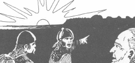
Read down the left-hand
column to the latitude designation
that most closely corresponds to the loc.
in question, and
read across to the appropriate month of
the year. The number
given at the intersection of the row and
column represents the
number of hours of daylight on each day
during the month in
question. For this purpose, "hours of
daylight" is defined as the
length of time between sunrise &&
sunset on a given day.
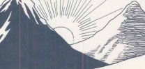
A shorter,
simpler version of this table can be obtained
by using only the middle row of figures for each climatic region
(the "80" l. for arctic, "60" for subarctic,
"40" for temperate, "25" for subtropical, and "10" for tropical).
This avoids the need for the DM to keep
track of latitude, instead being concerned
only with the climatic region for which
the hours of daylight
are being determined.
Note that this table does not indicate
the precise times of day at
which sunrise && sunset occur;
if these determinations are important,
they can be arrived at logically (using
midnight as the
midpoint of the nighttime period and noon
as the midpoint of the
daytime period), or they can be stipulated
by the DM based on either
real-world xperience or the particular
characteristics of the
campaign world.
Lydia
(goddess of daylight)
Twilight

As noted above, a figure for "hours
of daylight" does not necessarily
indicate the span of time
in a day during which activities
can be conducted without the need for
artificial illumination. Each
day also has two periods of twilight,
immed. preceding sunrise
and immed. following sunset, during which
the sun still
casts a significant amount of light across
the sky. As noted in the
first section of this book (see Vision
&& Visibility), twilight conditions
have an effect on how far characters can
see.
Each twilight period lasts about 30 minutes
at the middle latitudes (30-40 degrees),
decreasing to a min. of 20 minutes at
the equator (0 degrees) and
increasing to 40 minutes at relatively
high latitudes (50-60 degrees).
Local terrain
conditions may affect this time span;
for instance,
twilight in a dense forest or on the side
of a mountain opposite the sun may only last for 5-10 minutes.
At extremely high latitudes for which
the "hours of daylight" figure is zero,
a twilight condition exists for 24 hours
every day.
If the sky is clear, The Sun will provide
enough light from its
position just below the horizon to make
normal activities psb.
w/o a constant need for an artificial
light source.
Xan Yae
(goddess of twilight)
Local
Winds
The "prevailing direction"
described for winds in the basic
weather system is
just that: the direction from which wind activity
will usu.
originate under non-extraordinary conditions. However,
it is certainly
not impossible to have (for nstance) easterly
winds in a temperate
location, particularly on land adjacent to a
large body of water
or over a small AREA of unusual terrain.
Along the coastline
of an ocean or a large lake, the land may be
swept by a "sea
breeze" that moves from the water to the land. If
the water is east
of the land, then an E. wind will result even if
the prevailing wind
comes from the opposite direction. A sea
breeze occurs during
daylight hours because the land gains heat
more rapidly than
the adjacent water. As the warm air over the
land rises, it is
replaced by cooler air that moves in from its previous
loc. over the water.
At night, the phenomenon is reversed
because te land
also loses heat more rapidly than the
water does. The
air over the water remains warm for a longer
time, and when the
two air masses are significantly different in <2>
temperature the
colder air over the land moves out and replaces
the warmer air over
the water. The reverse phenomenon is
called, logically
enough, a "land breeze." It can also result in
wind that moves
contrary to the prevailing direction -- for instance,
where the prevailing
direction is W but a body of water is located to the W of a land mass.
A sea breeze is usu.
stronger than a land breeze produced
in the same loc.,
but neither type of wind current normally
moves very far inland
(five or ten miles at the most). Both types of <5 or 10>
breezes are more
likely to occur when the sky is clear, because
cloudy skies tned
to inhibit the transfer of heat through the air. At
times, the temperature
along a seacoast may be markedly lower
than the temperature
only a few miles inland; when a sea breeze
occurs, this is
almost always the case, although other factors
(such as cold ocean
currents) may also contribute to this disparity
in temperature.
Unusual terrain features
can also bring about unusual wind
patterns. For instance,
if the eastern edge of a flat plain ends
abruptly in a cliff
face that rises thousands of feet above the level
of the plain, then
a prevailing westerly wind will be "trapped"
when it reaches
the cliff face. The result may be a swirling wind
that can come from
different directions in locations only a few
hundred yards apart
(and might be conducive to the formation of
a storm or a tornado
if other conditions are right for such an occurrence).
If the westerly
wind is relatively light, it may simply
double back on itself
and produce an AREA of calm air in the immediate
vicinity of the
cliff as the westerly and easterly flows effectively
cancel each other
out.
As with other aspects
of this weather system, the DM is encouraged
to modify, xtrapolate
from, or even ignore certain "facts"
about wind direction
and velocity for the skae of variety, or to account
for out-of-the-ordinary
combinations of terrain && climate
that may have no
correlation to features found in our real world.
Tides

The movement of ocean
water caused by the gravitational pull
of Earth's moon
and The Sun have
no direct effect on weather or
on the conditions
of the physical environment -- except, of
course, on land
areas bordering the ocean. A simplified description
of tides that simulates
real-world conditions is presented
here for the DM's
USE when desired && appro.
High tide &&
low tide occur twice each day on an alternating sequence;
each high tide is
separated from the next high tide by 12 hours,
and the low tide
occurs 6 hours after each high tide.
Because the moon
orbits the Earth approximately once every 25 hours,
the times of high
and low tides advance by about an hour each day.
This distinction
is not usu. important, but may be significant
if the PCs spend
more than one day in <1>
id. seacoast
loc.. (If they don't know any better, they
may expect the next
day's high tides to occur at id. time as
the current day's
-- an in certain circumstances, this could TURN
out to be an important
miscalculation.)
The moon goes through
its full cycle of phases once every 28 days,
or roughly once
per month. The difference between the water
level at high tide
and the water level at low tide is greatest during
the seven-day periods
surrounding the full moon and the new
moon; these are
called spring tides. The difference in
water levels is
much less pronounced when The Moon is waxing (moving
from new to full)
or waning (moving from full to new); these are
the periods of neap
tides.
On the average,
the difference in
water level between high and low tide ranges from 5-7 feet (during neap
tides) to 15-18 feet (during spring tides).
The variation in
depth is less than this along
a coastline bordering
a very large body of water, and may be substantially
greater than the
avg. along a coastline bodering a
smaller body of
water partially enclosed by land. e.g.,
the variation in
tide depth along the coast of N. and S.
America bordering
the Pacific Ocean is relatively small,
because the ocean
water has a lot of room to MOVE.
In contrast, the
variation
between high &&
low tide in the Bay of Fundy (betwen New
Brunswick and Nova
Scotia in eastern Canada) is often as much
as 60 feet, because
the water in the bay has much less freedom
of movement. Imagine
a gallon of water poured into a bathtub
and set in motion
so that it splashes from side to side lengthwise
in the tub; the
difference between "high tide" and "low tide"
along the sides
of the tub will not be very great. Pour the same
gallon of water
into the kitchen sink and set it in motion with the
same amount of force,
and it might move against the sides of the
sink so vigorously
that it actually splashes out of the container.
If it is important
to determine the AREA of seacoast covered by high tide (and uncovered at
low tide),
the DM can use these
guidelines:
If the land slopes
gently toward the sea (not more than 30 degrees of slant),
high tide will come
in a distance of 4 to 5 times the height of the tide.
If the slope of
the seacoast is moderate (31 to 50 degrees),
high tide will come
in 2 to 3 times the height of the tide.
If the slope of
the seacoast is severe (51 to 70 degrees),
high tide will come
in 1 to 2 times the height of the tide.
Examples:
If the difference in height between high tide and low tide is 15 feet and
the seacoast has a gentle slope,
the
sea water at high tide will encroach on the land 60 to 75 feet farther
inland than it does at low tide.
If
the difference in height between high tide and low tide is 5 feet and the
seacoast is a moderate slope,
the
sea water at high tide will encroach the land 10 to 15 feet farther inland
than it does at low tide.
The DM's Responsibility
As brought out in the introduction to the
appendix, this
weather-determination system does not
attempt to acct. for all
of the possible combos of terrain, climate,
and weather phenomena
that can occur in our real world. Of course,
it also cannot
consider the fantastic properties that
an imaginative DM
might incorporate into the world in which
his campaign
takes place. However, it is hoped that
what is given here will
serve as a flexible framework that the
DM can modify.
For instance, day-by-day weather determination
may be seen
as too cumbersome and time-consuming.
In that case, you may
decide to make each determination apply
for two or three days in <2 or 3>
succession instead of just one. This tactic
may be particularly <1>
useful when a party of PCs is simply moving
from
one place to another on an extended journey
through the wilderness,
and you want to compress game time to
get the mundane
period of traveling out of the way. Of
course, you can swtich between
various time frames as desired or appro:
determine
the weather for a single day, then let
the next set of dice rolls dictate
conditions for a two- || three- day period,
and then DROP back <2 or 3>
to a one-day determination for a certain
purpose. <1>
If a playing session is to xtend over several
days of game
time, it is psb. (and recommended) for
the DM to
predetermine the weather conditions for
the entire several-day
period before the playing session begins.
By doing this, you can
avoid disrupting the flow and continuity
of the PCs'
activities and thereby maintain the desired
flavore of the role-playing
adventure. (It may prove difficult for
players to remain "in
character" if you call a five-minute halt
to play at midnight of each <5>
new game-day in order to roll some dice
and consult a few tables
to find out what the coming day will be
like.)
Table A4: SPECIAL WEATHER
| - |
- |
Winter A |
B |
C |
Spring
A |
B |
C |
Summer A |
B |
C |
Autumn
A |
B |
C |
| Arctic |
D |
|
|
|
|
|
|
|
|
|
|
|
|
| - |
H |
|
|
|
|
|
|
|
|
|
|
|
|
| - |
M |
|
|
|
|
|
|
|
|
|
|
|
|
| - |
P |
|
|
|
|
|
|
|
|
|
|
|
|
| - |
Se |
|
|
|
|
|
|
|
|
|
|
|
|
| - |
- |
Winter A |
B |
C |
Spring
A |
B |
C |
Summer A |
B |
C |
Autumn
A |
B |
C |
| Subarctic |
D |
|
|
|
|
|
|
|
|
|
|
|
|
| - |
F |
|
|
|
|
|
|
|
|
|
|
|
|
| - |
H |
|
|
|
|
|
|
|
|
|
|
|
|
| - |
M |
|
|
|
|
|
|
|
|
|
|
|
|
| - |
P |
|
|
|
|
|
|
|
|
|
|
|
|
| - |
Se |
|
|
|
|
|
|
|
|
|
|
|
|
| - |
Sw |
|
|
|
|
|
|
|
|
|
|
|
|
| - |
- |
Winter A |
B |
C |
Spring
A |
B |
C |
Summer A |
B |
C |
Autumn
A |
B |
C |
| Temperate |
D |
|
|
|
|
|
|
|
|
|
|
|
|
| - |
F |
|
|
|
|
|
|
|
|
|
|
|
|
| - |
H |
|
|
|
|
|
|
|
|
|
|
|
|
| - |
M |
|
|
|
|
|
|
|
|
|
|
|
|
| - |
P |
|
|
|
|
|
|
|
|
|
|
|
|
| - |
Se |
|
|
|
|
|
|
|
|
|
|
|
|
| - |
Sw |
|
|
|
|
|
|
|
|
|
|
|
|
| - |
- |
Winter A |
B |
C |
Spring
A |
B |
C |
Summer A |
B |
C |
Autumn
A |
B |
C |
| Subtropical |
D |
|
|
|
|
|
|
|
|
|
|
|
|
| - |
F |
|
|
|
|
|
|
|
|
|
|
|
|
| - |
H |
|
|
|
|
|
|
|
|
|
|
|
|
| - |
M |
|
|
|
|
|
|
|
|
|
|
|
|
| - |
P |
|
|
|
|
|
|
|
|
|
|
|
|
| - |
Se |
|
|
|
|
|
|
|
|
|
|
|
|
| - |
Sw |
|
|
|
|
|
|
|
|
|
|
|
|
| - |
- |
Winter A |
B |
C |
Spring
A |
B |
C |
Summer A |
B |
|
Autumn
A |
B |
C |
| Tropical |
D |
|
|
|
|
|
|
|
|
|
|
|
|
| - |
F |
|
|
|
|
|
|
|
|
|
|
|
|
| - |
H |
|
|
|
|
|
|
|
|
|
|
|
|
| - |
M |
|
|
|
|
|
|
|
|
|
|
|
|
| - |
P |
|
|
|
|
|
|
|
|
|
|
|
|
| - |
Se |
|
|
|
|
|
|
|
|
|
|
|
|
| - |
Sw |
|
|
|
|
|
|
|
|
|
|
|
|
Table 31:
| - |
- |
Winter |
Spring |
Summer |
Autumn |
| Arctic |
D |
|
|
|
|
| - |
H |
|
|
|
|
| - |
M |
|
|
|
|
| - |
P |
|
|
|
|
| - |
Se |
|
|
|
|
| - |
- |
Winter |
Spring |
Summer |
Autumn |
| Subarctic |
D |
|
|
|
|
| - |
F |
|
|
|
|
| - |
H |
|
|
|
|
| - |
M |
|
|
|
|
| - |
P |
|
|
|
|
| - |
Se |
|
|
|
|
| - |
Sw |
|
|
|
|
| - |
- |
Winter |
Spring |
Summer |
Autumn |
| Temperate |
D |
|
|
|
|
| - |
F |
|
|
|
|
| - |
H |
|
|
|
|
| - |
M |
|
|
|
|
| - |
P |
|
|
|
|
| - |
Se |
|
|
|
|
| - |
Sw |
|
|
|
|
| - |
- |
Winter |
Spring |
Summer |
Autumn |
| Subtropical |
D |
|
|
|
|
| - |
F |
|
|
|
|
| - |
H |
|
|
|
|
| - |
M |
|
|
|
|
| - |
P |
|
|
|
|
| - |
Se |
|
|
|
|
| - |
Sw |
|
|
|
|
| - |
- |
Winter |
Spring |
Summer |
Autumn |
| Tropical |
D |
|
|
|
|
| - |
F |
|
|
|
|
| - |
H |
|
|
|
|
| - |
M |
|
|
|
|
| - |
P |
|
|
|
|
| - |
Se |
|
|
|
|
| - |
Sw |
|
|
|
|
UA/POSTER PANEL MAP (DMG.B) EXAMPLE (Finish:
You get the idea!)
*template***template*


 -
-  -
-


